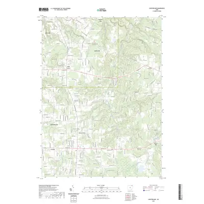
2023 Map of Chesterland
USGS Topo · Published 2023About this map
The boundary between Lake and Geauga counties divides this landscape of deeply carved creek beds and residential enclaves. Centered on Chesterland, the geography is defined by the high ground of Gildersleeve Mtn and Piersons Knob, which overlook the watershed of the East Branch Chagrin River. The map reveals a high density of burial sites for a single quadrangle, documenting the heritage of early communities at Pecks Corners, Chester Center, and Scotland.
Find a feature on this map
189 named features on this map. Tap any name to fly to it.
Don’t see what you’re looking for? This feature index may not catch every label — zoom into the map to look around manually.
Map Details
Editions of this 2023 Chesterland Map
This is the sole edition of this map. No revisions or reprints were ever made.
Other maps of this area

1904 · Chardon
USGS Topo · 1:62,500

1905 · Garrettsville
USGS Topo · 1:62,500

1905 · Mentor
USGS Topo · 1:62,500

1906 · Chardon
USGS Topo · 1:62,500

1906 · Chagrin Falls
USGS Topo · 1:62,500

1907 · Garrettsville
USGS Topo · 1:62,500

1907 · Mentor
USGS Topo · 1:62,500

1908 · Chagrin Falls
USGS Topo · 1:62,500

1950 · Cleveland
USGS Topo · 1:250,000

1953 · Chardon
USGS Topo · 1:24,000