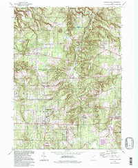
1994 Map of Chesterland
USGS Topo · Published 1997About this map
The Chagrin River and its East Branch carve a deep valley through this portion of northeast Ohio, anchoring a landscape where established township centers meet expansive green spaces. The northern reaches are dominated by the Holden Arboretum, featuring a network of water bodies including Corning Lake and Blueberry Pond. Settlement patterns follow the grid of historic throughways like Chillicothe Road, where crossroads such as Mulberry Corners and Pecks Corners mark long-standing community nodes.
Find a feature on this map
44 named features on this map. Tap any name to fly to it.
Don’t see what you’re looking for? This feature index may not catch every label — zoom into the map to look around manually.
Map Details
Editions of this 1994 Chesterland Map
This is the sole edition of this map. No revisions or reprints were ever made.
Other maps of this area

1904 · Chardon
USGS Topo · 1:62,500

1905 · Garrettsville
USGS Topo · 1:62,500

1905 · Mentor
USGS Topo · 1:62,500

1906 · Chardon
USGS Topo · 1:62,500

1906 · Chagrin Falls
USGS Topo · 1:62,500

1907 · Garrettsville
USGS Topo · 1:62,500

1907 · Mentor
USGS Topo · 1:62,500

1908 · Chagrin Falls
USGS Topo · 1:62,500

1950 · Cleveland
USGS Topo · 1:250,000

1953 · Chardon
USGS Topo · 1:24,000