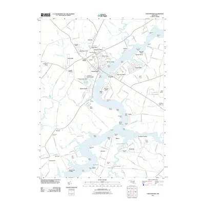
2011 Map of Chestertown
USGS Topo · Published 2011About this map
Chestertown and its surrounding riverine landscape are defined by the winding course of the Chester River, which separates the Kent County shoreline from the neighboring lands of Queen Anne's County. This 2011 survey captures a mix of residential expansion and maritime infrastructure, with suburban developments like Chesmar, Washington Park, and Heather Heights situated near the historic core. The waterfront is characterized by numerous points and reaches, such as Devils Reach and Fryingpan Point, alongside a series of historic landing sites including Roundtop Wharf, Newmans Wharf, and Riverside Wharf.
Find a feature on this map
169 named features on this map. Tap any name to fly to it.
Don’t see what you’re looking for? This feature index may not catch every label — zoom into the map to look around manually.
Map Details
Editions of this 2011 Chestertown Map
This is the sole edition of this map. No revisions or reprints were ever made.
Other maps of this area

1898 · Tolchester
USGS Topo · 1:125,000

1899 · Dover
USGS Topo · 1:125,000

1900 · Cecilton
USGS Topo · 1:62,500

1900 · Betterton
USGS Topo · 1:62,500

1901 · Chestertown
USGS Topo · 1:62,500

1903 · Tolchester
USGS Topo · 1:125,000

1905 · Barclay
USGS Topo · 1:62,500

1906 · Dover
USGS Topo · 1:125,000

1908 · Tolchester
USGS Topo · 1:125,000

1920 · Dover
USGS Topo · 1:125,000