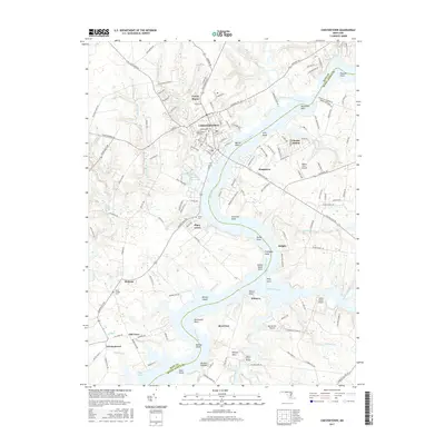
2017 Map of Chestertown
USGS Topo · Published 2017About this map
The Chestertown waterfront and the winding course of the Chester River define the character of this Eastern Shore landscape. The map details the transition from the concentrated historic core of the town to established residential developments like Foxley Manor and Chester Harbor. Along the riverbanks, numerous named points such as Peachtree Point and Primrose Point overlook the tidal waters, while the interior is marked by long-standing agricultural communities including Pomona and Kingstown.
Find a feature on this map
152 named features on this map. Tap any name to fly to it.
Don’t see what you’re looking for? This feature index may not catch every label — zoom into the map to look around manually.
Map Details
Editions of this 2017 Chestertown Map
This is the sole edition of this map. No revisions or reprints were ever made.
Other maps of this area

1898 · Tolchester
USGS Topo · 1:125,000

1899 · Dover
USGS Topo · 1:125,000

1900 · Cecilton
USGS Topo · 1:62,500

1900 · Betterton
USGS Topo · 1:62,500

1901 · Chestertown
USGS Topo · 1:62,500

1903 · Tolchester
USGS Topo · 1:125,000

1905 · Barclay
USGS Topo · 1:62,500

1906 · Dover
USGS Topo · 1:125,000

1908 · Tolchester
USGS Topo · 1:125,000

1920 · Dover
USGS Topo · 1:125,000