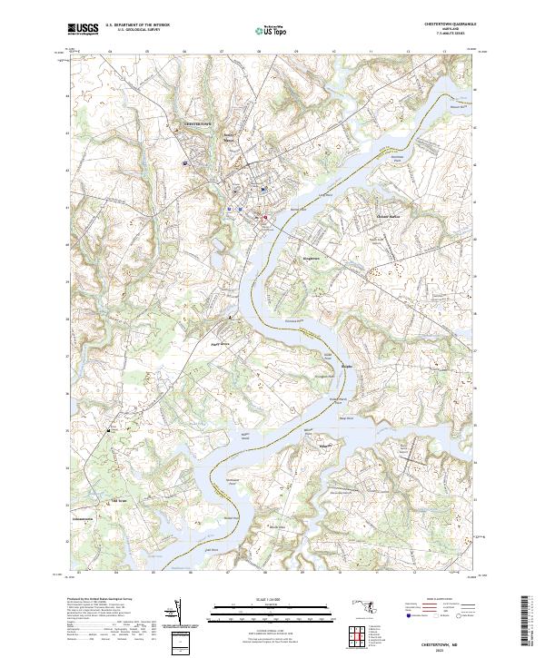
2023 Map of Chestertown
USGS Topo · Published 2023About this map
Chestertown serves as the historic and educational hub of this landscape, dominated by the winding course of the Chester River. The town's colonial roots and institutional significance are visible through the grounds of Washington College and the central Kent County Courthouse. The river's influence on the local geography is evident in the numerous points and necks that define the shoreline, such as Primrose Point, Wilmer Neck, and Fryingpan Point.
Find a feature on this map
148 named features on this map. Tap any name to fly to it.
Don’t see what you’re looking for? This feature index may not catch every label — zoom into the map to look around manually.
Map Details
Editions of this 2023 Chestertown Map
This is the sole edition of this map. No revisions or reprints were ever made.
Other maps of this area

1898 · Tolchester
USGS Topo · 1:125,000

1899 · Dover
USGS Topo · 1:125,000

1900 · Cecilton
USGS Topo · 1:62,500

1900 · Betterton
USGS Topo · 1:62,500

1901 · Chestertown
USGS Topo · 1:62,500

1903 · Tolchester
USGS Topo · 1:125,000

1905 · Barclay
USGS Topo · 1:62,500

1906 · Dover
USGS Topo · 1:125,000

1908 · Tolchester
USGS Topo · 1:125,000

1920 · Dover
USGS Topo · 1:125,000