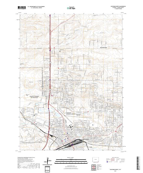
2021 Map of Cheyenne North
USGS Topo · Published 2021About this map
Cheyenne and its northward expansion toward Ranchettes define this high-plains landscape, where the urban grid meets the open terrain of Laramie County. The southern portion of the sheet is densely packed with civic and religious institutions, including Saint Mary's Catholic Church and the Saint Mark's Episcopal Church Columbarium. Significant acreage is dedicated to commemorative and military sites, such as Warren AFB and a cluster of historic burial grounds including Lakeview Cem, Olivet Cem, and the Odd Fellows Cem.
Find a feature on this map
373 named features on this map. Tap any name to fly to it.
Don’t see what you’re looking for? This feature index may not catch every label — zoom into the map to look around manually.
Map Details
Editions of this 2021 Cheyenne North Map
This is the sole edition of this map. No revisions or reprints were ever made.
Other maps of this area

1911 · Cheyenne
USGS Topo · 1:125,000

1914 · Cheyenne
USGS Topo · 1:125,000

1950 · Cheyenne
USGS Topo · 1:62,500

1954 · Cheyenne
USGS Topo · 1:250,000

1958 · Cheyenne
USGS Topo · 1:250,000

1961 · Round Top Lake
USGS Topo · 1:24,000

1961 · Cheyenne South
USGS Topo · 1:24,000
1961 · Borie
USGS Topo · 1:24,000

1961 · Cheyenne
USGS Topo · 1:62,500

1961 · Cheyenne North
USGS Topo · 1:24,000