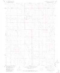
1982 Map of Cheyenne Wells 3 SE
USGS Topo · Published 1982About this map
Sheridan stands as the primary reference point in this high-plains landscape along the border of Cheyenne Co and Kiowa Co. This 1982 survey reveals a rural area defined by agricultural infrastructure and water management, where numerous Wells are critical to sustaining the arid environment. The map details localized industrial activity through several Gravel Pits, likely supporting the maintenance of the local road network. Grain storage and resource management are evident in the placement of Storage Bins and several Tanks across the sections. The sparse distribution of named features underscores the vast, open character of this part of eastern Colorado, where small settlements like Sheridan serve as vital hubs for the surrounding ranching and farming communities during the late twentieth century.
Find a feature on this map
6 named features on this map. Tap any name to fly to it.
Don’t see what you’re looking for? This feature index may not catch every label — zoom into the map to look around manually.
Map Details
Editions of this 1982 Cheyenne Wells 3 SE Map
2 editions found
Other maps of this area

1890 · Granada
USGS Topo · 1:125,000

1892 · Cheyenne Wells
USGS Topo · 1:125,000

1892 · Granada
USGS Topo · 1:125,000

1894 · Cheyenne Wells
USGS Topo · 1:125,000

1894 · Granada
USGS Topo · 1:125,000

1954 · Lamar
USGS Topo · 1:250,000

1958 · Lamar
USGS Topo · 1:250,000

1968 · Stuart
USGS Topo · 1:24,000

1968 · Sheridan Lake
USGS Topo · 1:24,000
1968 · Brandon
USGS Topo · 1:24,000