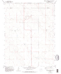
1982 Map of North Of Sheridan Lake
USGS Topo · Published 1995About this map
Cheyenne Co and Kiowa Co meet along a straight surveyor's line in this high-plains landscape, where the agricultural economy of the early 1980s is defined by isolated infrastructure and water management. The small settlement of Sheridan serves as a focal point in a territory otherwise dominated by sparse ranching or farming operations. Evidence of the region's industrial and logistical needs is found in several Gravel Pits, clusters of Storage Bins, and Tanks located near section lines. The presence of multiple Wells scattered across the township grid underscores the critical nature of groundwater for sustaining life and industry on the semi-arid Colorado plains. This survey represents the area shortly after the mid-1970s aerial data collection, preserving the exact placement of fence lines and rural improvements during this period.
Find a feature on this map
6 named features on this map. Tap any name to fly to it.
Don’t see what you’re looking for? This feature index may not catch every label — zoom into the map to look around manually.
Map Details
Editions of this 1982 North Of Sheridan Lake Map
2 editions found
Other maps of this area

1890 · Granada
USGS Topo · 1:125,000

1892 · Cheyenne Wells
USGS Topo · 1:125,000

1892 · Granada
USGS Topo · 1:125,000

1894 · Cheyenne Wells
USGS Topo · 1:125,000

1894 · Granada
USGS Topo · 1:125,000

1954 · Lamar
USGS Topo · 1:250,000

1958 · Lamar
USGS Topo · 1:250,000

1968 · Stuart
USGS Topo · 1:24,000

1968 · Sheridan Lake
USGS Topo · 1:24,000
1968 · Brandon
USGS Topo · 1:24,000