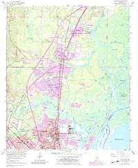
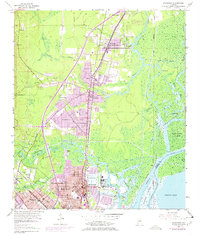
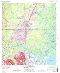
1953 Map of Chickasaw
USGS Topo · Published 1983About this map
Mobile River and Spanish River define the eastern industrial edge of this region north of Mobile, where heavy industry and residential growth meet the marshy lowlands. The 1953 survey, updated with purple revisions in the early 1980s, shows the transition of Saraland and Satsuma as they expanded alongside the Burlington Southern Craft and Louisville and Nashville Railroad lines. Notable for genealogists are the Saraland Cem and Myers Cem, while the waterfront is dominated by the Ship Yard and intricate waterways like Gunnison Creek and Sara Bayou. The landscape includes several islands such as Twelvemile Island and Blakeley Island, illustrating the complex delta environment that shaped the development of Chickasaw and Prichard.
Find a feature on this map
63 named features on this map. Tap any name to fly to it.
Don’t see what you’re looking for? This feature index may not catch every label — zoom into the map to look around manually.
Map Details
Editions of this 1953 Chickasaw Map
6 editions found
Other maps of this area

1921 · Fairhope
USGS Topo · 1:62,500

1922 · Mobile
USGS Topo · 1:62,500

1940 · Mobile
USGS Topo · 1:31,680

1940 · Mobile
USGS Topo · 1:62,500

1941 · Chickasaw
USGS Topo · 1:31,680

1941 · Blakeley
USGS Topo · 1:31,680

1941 · Bay Minette
USGS Topo · 1:62,500

1941 · Creola
USGS Topo · 1:62,500

1941 · Fairhope
USGS Topo · 1:62,500

1942 · Hurricane
USGS Topo · 1:31,680