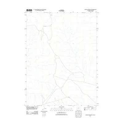
2012 Map of Chicken Creek SE
USGS Topo · Published 2012About this map
Alkali Cr winds through this sparsely settled corner of Sweetwater County, marking the primary drainage in an arid landscape defined by intermittent watercourses. The map traces a network of resource-management roads, most notably the winding path of BLM Road 4407 and the more direct course of Hiawatha Rd in the southern portion of the quadrangle. These routes reflect the modern administration of public lands by the Bureau of Land Management, where the geometric grid of the Public Land Survey System meets the natural contours of the high desert terrain. The absence of traditional settlements emphasizes the region's character as a working landscape dedicated to grazing and mineral management, rather than permanent habitation.
Find a feature on this map
3 named features on this map. Tap any name to fly to it.
Don’t see what you’re looking for? This feature index may not catch every label — zoom into the map to look around manually.
Map Details
Editions of this 2012 Chicken Creek SE Map
This is the sole edition of this map. No revisions or reprints were ever made.
Other maps of this area

1954 · Vernal
USGS Topo · 1:250,000

1954 · Rock Springs
USGS Topo · 1:250,000

1958 · Vernal
USGS Topo · 1:250,000

1958 · Rock Springs
USGS Topo · 1:250,000

1960 · Vernal
USGS Topo · 1:250,000

1962 · Rock Springs
USGS Topo · 1:250,000

1966 · Sugarloaf Butte
USGS Topo · 1:24,000

1966 · Hiawatha
USGS Topo · 1:24,000

1968 · Chicken Creek East
USGS Topo · 1:24,000
1968 · Chicken Creek SW
USGS Topo · 1:24,000