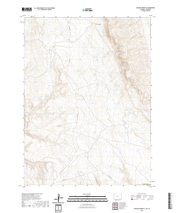
2021 Map of Chicken Creek SE
USGS Topo · Published 2021About this map
Kinney Rim dominates this high-desert landscape in southern Sweetwater County, marking a distinct topographical transition where the plateau breaks away into complex drainage systems. The ruggedness of the terrain is evident in the deeply incised Hells Canyon and the winding course of Crooked Wash, which define the central and northern sections of the survey. The mapping reveals a sparse infrastructure of administrative and access roads, primarily the Hiawatha Rd and Blm Rd 4407, which navigate the elevation changes to connect remote points of this southwestern Wyoming environment. This modern survey provides a detailed view of the Public Land Survey System boundaries, showing the intersection of Townships 12 and 13 North near the Colorado border, essential for researchers tracking land allotments and natural resource management in the region.
Find a feature on this map
11 named features on this map. Tap any name to fly to it.
Don’t see what you’re looking for? This feature index may not catch every label — zoom into the map to look around manually.
Map Details
Editions of this 2021 Chicken Creek SE Map
This is the sole edition of this map. No revisions or reprints were ever made.
Other maps of this area

1954 · Vernal
USGS Topo · 1:250,000

1954 · Rock Springs
USGS Topo · 1:250,000

1958 · Vernal
USGS Topo · 1:250,000

1958 · Rock Springs
USGS Topo · 1:250,000

1960 · Vernal
USGS Topo · 1:250,000

1962 · Rock Springs
USGS Topo · 1:250,000

1966 · Sugarloaf Butte
USGS Topo · 1:24,000

1966 · Hiawatha
USGS Topo · 1:24,000

1968 · Chicken Creek East
USGS Topo · 1:24,000
1968 · Chicken Creek SW
USGS Topo · 1:24,000