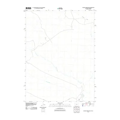
2010 Map of Chicken Creek SW
USGS Topo · Published 2010About this map
Vermillion Creek meanders through this high-desert landscape in southern Sweetwater County, Wyoming, just north of the Colorado border. The drainage network is clearly defined by several significant seasonal watercourses, including Granary Draw, Horseshoe Wash, and Alkali Creek, which characterize the arid terrain of this region. Human activity is evidenced by industrial and transit infrastructure, most notably the Myers Mine located near the southern boundary. This site and the nearby Hiawatha Rd indicate the area's continued role in resource extraction and regional connectivity. The map provides a detailed view of the section lines and topography during the first decade of the 21st century, showing how the land is partitioned for grazing or mineral interests while remaining largely undeveloped.
Find a feature on this map
6 named features on this map. Tap any name to fly to it.
Don’t see what you’re looking for? This feature index may not catch every label — zoom into the map to look around manually.
Map Details
Editions of this 2010 Chicken Creek SW Map
This is the sole edition of this map. No revisions or reprints were ever made.
Other maps of this area

1954 · Vernal
USGS Topo · 1:250,000

1954 · Rock Springs
USGS Topo · 1:250,000

1958 · Vernal
USGS Topo · 1:250,000

1958 · Rock Springs
USGS Topo · 1:250,000

1960 · Vernal
USGS Topo · 1:250,000

1962 · Rock Springs
USGS Topo · 1:250,000

1963 · Erickson-Kent Ranch
USGS Topo · 1:24,000

1963 · Scrivner Butte
USGS Topo · 1:24,000

1966 · Sugarloaf Butte
USGS Topo · 1:24,000
1966 · Sparks
USGS Topo · 1:24,000