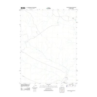
2012 Map of Chicken Creek SW
USGS Topo · Published 2012About this map
The Vermillion Cr and its network of dry drainages define this stretch of the high desert along the Wyoming-Colorado border. Centered on a sparsely populated landscape of ranching and natural gas infrastructure, the map highlights the Erickson-Kent Ranch in the northwestern quadrant as a primary waypoint in an area otherwise dominated by seasonal watercourses like Alkali Cr and Granary Draw. Transportation through this arid basin relies on Hiawatha Rd, which cuts across the southern portion of the sheet toward Horseshoe Wash. This 2012 survey illustrates the modern configuration of access roads and land use in a region where geography is dictated by the availability of water and the reach of remote cattle operations.
Find a feature on this map
6 named features on this map. Tap any name to fly to it.
Don’t see what you’re looking for? This feature index may not catch every label — zoom into the map to look around manually.
Map Details
Editions of this 2012 Chicken Creek SW Map
This is the sole edition of this map. No revisions or reprints were ever made.
Other maps of this area

1954 · Vernal
USGS Topo · 1:250,000

1954 · Rock Springs
USGS Topo · 1:250,000

1958 · Vernal
USGS Topo · 1:250,000

1958 · Rock Springs
USGS Topo · 1:250,000

1960 · Vernal
USGS Topo · 1:250,000

1962 · Rock Springs
USGS Topo · 1:250,000

1963 · Erickson-Kent Ranch
USGS Topo · 1:24,000

1963 · Scrivner Butte
USGS Topo · 1:24,000

1966 · Sugarloaf Butte
USGS Topo · 1:24,000
1966 · Sparks
USGS Topo · 1:24,000