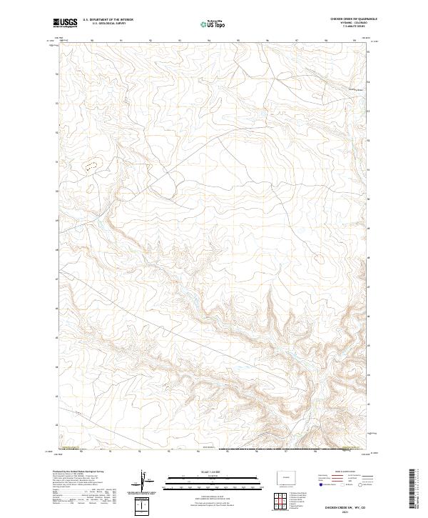
2021 Map of Chicken Creek SW
USGS Topo · Published 2021About this map
The arid drainage patterns of Sweetwater County define this modern look at the southern Wyoming borderlands. The landscape is carved by the winding course of Vermillion Creek, which travels south through the center of the sheet towards the Colorado line. To the east, Alkali Creek and the topographic feature known as Granary Draw provide significant relief in a region dominated by sagebrush and open range. Remote infrastructure is limited to the southern portion of the map, where Hiawatha Road and County Road 25 provide transit through the high desert. This survey provides a precise accounting of the Public Land Survey System grid, including townships t13n r100w and t12n r101w, which are essential for property and mineral rights research in the Great Divide Basin area.
Find a feature on this map
11 named features on this map. Tap any name to fly to it.
Don’t see what you’re looking for? This feature index may not catch every label — zoom into the map to look around manually.
Map Details
Editions of this 2021 Chicken Creek SW Map
This is the sole edition of this map. No revisions or reprints were ever made.
Other maps of this area

1954 · Vernal
USGS Topo · 1:250,000

1954 · Rock Springs
USGS Topo · 1:250,000

1958 · Vernal
USGS Topo · 1:250,000

1958 · Rock Springs
USGS Topo · 1:250,000

1960 · Vernal
USGS Topo · 1:250,000

1962 · Rock Springs
USGS Topo · 1:250,000

1963 · Erickson-Kent Ranch
USGS Topo · 1:24,000

1963 · Scrivner Butte
USGS Topo · 1:24,000

1966 · Sugarloaf Butte
USGS Topo · 1:24,000
1966 · Sparks
USGS Topo · 1:24,000