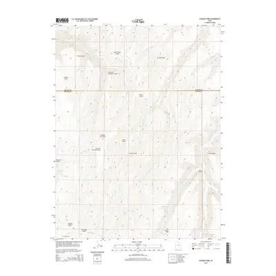
2014 Map of Chicken Fork
USGS Topo · Published 2014About this map
Stevens Cabin sits near the southern boundary of this remote high-desert terrain, where the headwaters of multiple canyon systems converge along the Uintah and Grand county line. The landscape is defined by dramatic drainage patterns, including the extensive East Fork Chandler Canyon and the deeply incised Moonwater Canyon. Water is the primary driver of name and place here, with essential landmarks like Chicken Spring, Moonwater Springs, and BP Spring providing vital points of reference in a region shaped by the Chicken Fork and Harris Fork branches. The sheer topography is marked by significant overlooks such as Chandler Point and the aptly named No Mans Land Point, while Post Canyon Ridge separates the complex network of ravines and draws that characterize this part of eastern Utah.
Find a feature on this map
23 named features on this map. Tap any name to fly to it.
Don’t see what you’re looking for? This feature index may not catch every label — zoom into the map to look around manually.
Map Details
Editions of this 2014 Chicken Fork Map
This is the sole edition of this map. No revisions or reprints were ever made.
Other maps of this area

1885 · East Tavaputs
USGS Topo · 1:250,000

1953 · Firewater Canyon
USGS Topo · 1:62,500

1956 · Grand Junction
USGS Topo · 1:250,000

1959 · Grand Junction
USGS Topo · 1:250,000

1960 · Grand Junction
USGS Topo · 1:250,000

1962 · Grand Junction
USGS Topo · 1:250,000

1963 · Tenmile Canyon
USGS Topo · 1:62,500

1963 · Moonwater Point
USGS Topo · 1:62,500

1964 · Grand Junction
USGS Topo · 1:250,000

1965 · Grand Junction
USGS Topo · 1:250,000