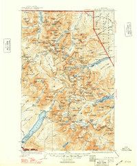
1904 Map of Chief Mountain
USGS Topo · Published 1948About this map
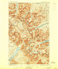
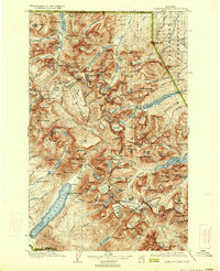
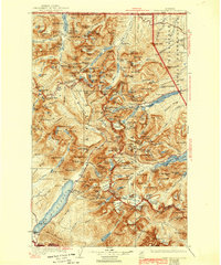
Glacier National Park and the adjacent Blackfeet Indian Reservation are charted here following revisions in the late 1930s. The landscape is defined by the Continental Divide, which separates waters flowing toward Waterton Lake in the north from those feeding the Lake McDonald basin in the southwest. This era of the park’s history is marked by the development of the Going-to-the-Sun Highway, which traverses the high peaks of the Lewis and Livingston Ranges. Early tourism and transportation infrastructure are evident at the Chalet near Many Glacier and the Great Northern Ry line passing through Belton. Local activity centers around small outposts like Apgar, Kellys Camp, and Rogers Ranch, reflecting a period when backcountry access was beginning to modernize while still maintaining its isolated character. Surveyors including Francois E. Matthes and R.H. Sargent established the primary topography, recording the high summits of Mt Jackson and Mt Stimson.
Find a feature on this map
245 named features on this map. Tap any name to fly to it.
Don’t see what you’re looking for? This feature index may not catch every label — zoom into the map to look around manually.
Map Details
Editions of this 1904 Chief Mountain Map
8 editions found
Other maps of this area

1901 · Browning
USGS Topo · 1:125,000

1903 · Browning
USGS Topo · 1:125,000

1904 · Chief Mountain
USGS Topo · 1:125,000

1906 · Kintla Lakes
USGS Topo · 1:125,000

1913 · Marias Pass
USGS Topo · 1:125,000

1914 · Nyack
USGS Topo · 1:125,000

1938 · Chief Mountain
USGS Topo · 1:125,000

1938 · Kintla Lakes
USGS Topo · 1:125,000

1943 · Kalispell
USGS Topo · 1:125,000

1957 · Kalispell
USGS Topo · 1:250,000