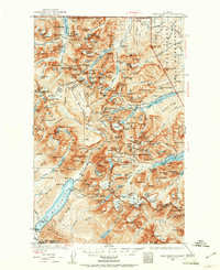
1938 Map of Chief Mountain
USGS Topo · Published 1961About this map
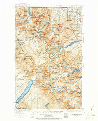
Glacier National Park defines this landscape, as it appeared before the mid-century expansion of automotive tourism. The network of high-country lodgings, including Swiftcurrent Chalet, Sperry Chalet, and Going to the Sun Chalet, illustrates an era when visitor infrastructure relied on remote outposts accessible via the nascent Going to the Sun Highway. To the east, the Blackfeet Indian Reservation meets the park boundary near the ridge of Chief Mountain. Along the shores of Waterton Lake, the Goat Haunt Ranger Sta stands near the United States-Dominion of Canada border, marking a significant point of international transit. Scattered camps like Kellys Camp and Kootenai Camp, along with the small settlement at Apgar, provide evidence of early residential and recreational clusters within the protected wilderness area.
Find a feature on this map
261 named features on this map. Tap any name to fly to it.
Don’t see what you’re looking for? This feature index may not catch every label — zoom into the map to look around manually.
Map Details
Editions of this 1938 Chief Mountain Map
8 editions found
Other maps of this area

1901 · Browning
USGS Topo · 1:125,000

1903 · Browning
USGS Topo · 1:125,000

1904 · Chief Mountain
USGS Topo · 1:125,000

1906 · Kintla Lakes
USGS Topo · 1:125,000

1913 · Marias Pass
USGS Topo · 1:125,000

1914 · Nyack
USGS Topo · 1:125,000

1938 · Chief Mountain
USGS Topo · 1:125,000

1938 · Kintla Lakes
USGS Topo · 1:125,000

1943 · Kalispell
USGS Topo · 1:125,000

1957 · Kalispell
USGS Topo · 1:250,000