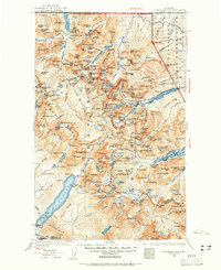
1938 Map of Chief Mountain
USGS Topo · Published 1965About this map
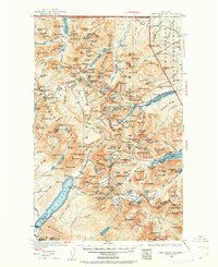
Glacier National Park dominates this 1938 revision, illustrating the high mountain landscape and early tourism infrastructure along the United States-Dominion of Canada border. The map showcases the newly established Going-to-the-Sun Hwy, a significant engineering feat that opened the interior to visitors, connecting the western gateway at Apgar and West Glacier to the eastern slopes. High-altitude destinations such as Sperry Chalet and Many Glacier Chalet are documented alongside backcountry routes through Ptarmigan Tunnel and Logan Pass. Localized sites like Kellys Camp and Rogers Ranch provide evidence of early private holdings and ranching within the park's expanded boundaries. Elevations reach their peak at Mt Cleveland, while massive water bodies like Lake McDonald and Waterton Lake anchor the drainage systems of the Continental Divide.
Find a feature on this map
230 named features on this map. Tap any name to fly to it.
Don’t see what you’re looking for? This feature index may not catch every label — zoom into the map to look around manually.
Map Details
Editions of this 1938 Chief Mountain Map
8 editions found
Other maps of this area

1901 · Browning
USGS Topo · 1:125,000

1903 · Browning
USGS Topo · 1:125,000

1904 · Chief Mountain
USGS Topo · 1:125,000

1906 · Kintla Lakes
USGS Topo · 1:125,000

1913 · Marias Pass
USGS Topo · 1:125,000

1914 · Nyack
USGS Topo · 1:125,000

1938 · Chief Mountain
USGS Topo · 1:125,000

1938 · Kintla Lakes
USGS Topo · 1:125,000

1943 · Kalispell
USGS Topo · 1:125,000

1957 · Kalispell
USGS Topo · 1:250,000