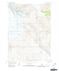
1963 Map of Chignik A-4
USGS Topo · Published 1982About this map
Mount Veniaminof dominates the western reaches of this high-latitude terrain, its ice-clad slopes feeding an intricate network of moving ice. Significant glaciers like Finger Glacier, Slim Glacier, and Harpoon Glacier descend from the heights of the Alaska Peninsula, carving the land as they move toward the coast. The mapping reflects a landscape of dramatic elevation changes and hydrological shifts, where the meltwater from Crab Glacier and its neighbors eventually feeds into systems such as the West Fork Chignik River.
Find a feature on this map
11 named features on this map. Tap any name to fly to it.
Don’t see what you’re looking for? This feature index may not catch every label — zoom into the map to look around manually.
Map Details
Editions of this 1963 Chignik A-4 Map
3 editions found
Other maps of this area

1951 · Stepovak Bay
USGS Topo · 1:250,000

1963 · Chignik A-4
USGS Topo · 1:63,360

1963 · Stepovak Bay D-4
USGS Topo · 1:63,360

1963 · Chignik B-5
USGS Topo · 1:63,360

1963 · Chignik B-4
USGS Topo · 1:63,360

1963 · Chignik A-5
USGS Topo · 1:63,360

1963 · Chignik A-3
USGS Topo · 1:63,360

1963 · Chignik B-3
USGS Topo · 1:63,360

1963 · Stepovak Bay D-5
USGS Topo · 1:63,360

1963 · Chignik
USGS Topo · 1:250,000