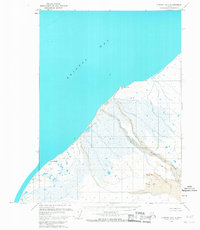
1963 Map of Chignik B-7
USGS Topo · Published 1967This historical map portrays the area of Chignik B-7 in 1963, primarily covering Aleutians East. Featuring a scale of 1:63360, this map provides a highly detailed snapshot of the terrain, roads, buildings, counties, and historical landmarks in the Chignik B-7 region at the time. Published in 1967, it is one of 2 known editions of this map due to revisions or reprints.
Find a feature on this map
12 named features on this map. Tap any name to fly to it.
Don’t see what you’re looking for? This feature index may not catch every label — zoom into the map to look around manually.
Map Details
Editions of this 1963 Chignik B-7 Map
2 editions found
Historical Maps of Aleutians East Through Time
381 maps found

1944 Cold Bay Sheet No. 1 of 25
Aleutians East Borough, AK

1944 Cold Bay Sheet No. 20 of 25
Aleutians East Borough, AK

1944 Cold Bay Sheet No. 2 of 25
Aleutians East Borough, AK

1949 Fort Randall
Aleutians East Borough, AK

1950 Fort Randall
Aleutians East Borough, AK

1951 Unimak
Aleutians East Borough, AK

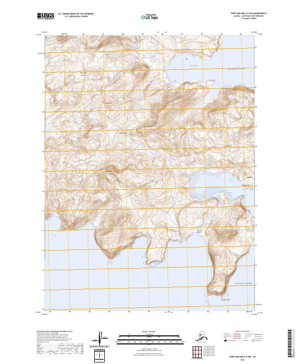
1953 Port Moller
Aleutians East Borough, AK

1955 Beechey Point B-5
Aleutians East Borough, AK

1958 Unimak
Aleutians East Borough, AK

1958 Unimak B-2 NE
Aleutians East Borough, AK

1963 Chignik A-6
Aleutians East Borough, AK

1963 Chignik A-7
Aleutians East Borough, AK

1963 Chignik A-8
Aleutians East Borough, AK

1963 Chignik B-7
Aleutians East Borough, AK

1963 Chignik C-5
Aleutians East Borough, AK

1963 Chignik C-6
Aleutians East Borough, AK

1963 Chignik D-4
Aleutians East Borough, AK

1963 Cold Bay B-3
Aleutians East Borough, AK

1963 Cold Bay B-4
Aleutians East Borough, AK

1963 Cold Bay C-1
Aleutians East Borough, AK

1963 Cold Bay C-2
Aleutians East Borough, AK

1963 Cold Bay D-1
Aleutians East Borough, AK

1963 False Pass C-1
Aleutians East Borough, AK

1963 False Pass C-2
Aleutians East Borough, AK

1963 False Pass D-0
Aleutians East Borough, AK

1963 False Pass D-1
Aleutians East Borough, AK

1963 False Pass D-2
Aleutians East Borough, AK

1963 False Pass D-3
Aleutians East Borough, AK

1963 Port Moller A-1
Aleutians East Borough, AK

1963 Port Moller A-2
Aleutians East Borough, AK

1963 Port Moller A-3
Aleutians East Borough, AK

1963 Port Moller A-4
Aleutians East Borough, AK

1963 Port Moller A-5
Aleutians East Borough, AK

1963 Port Moller A-6
Aleutians East Borough, AK

1963 Port Moller B-1
Aleutians East Borough, AK

1963 Port Moller B-2
Aleutians East Borough, AK

1963 Port Moller C-1
Aleutians East Borough, AK

1963 Port Moller C-2
Aleutians East Borough, AK

1963 Port Moller C-5
Aleutians East Borough, AK

1963 Port Moller C-6
Aleutians East Borough, AK

1963 Port Moller D-1
Aleutians East Borough, AK

1963 Port Moller D-2
Aleutians East Borough, AK

1963 Port Moller D-3
Aleutians East Borough, AK

1963 Port Moller D-4
Aleutians East Borough, AK

1963 Port Moller D-5
Aleutians East Borough, AK

1963 Port Moller D-6
Aleutians East Borough, AK

1963 Simeonof Island
Aleutians East Borough, AK

1963 Simeonof Island D-1
Aleutians East Borough, AK

1963 Simeonof Island D-2
Aleutians East Borough, AK

1963 Simeonof Island D-3
Aleutians East Borough, AK

1963 Simeonof Island D-4
Aleutians East Borough, AK

1963 Stepovak Bay A-5
Aleutians East Borough, AK

1963 Stepovak Bay A-6
Aleutians East Borough, AK

1963 Stepovak Bay B-6
Aleutians East Borough, AK

1963 Stepovak Bay C-5 and C-6
Aleutians East Borough, AK

1963 Stepovak Bay D-6
Aleutians East Borough, AK

1967 Simeonof Island
Aleutians East Borough, AK

1983 Cold Bay A-1
Aleutians East Borough, AK

1983 Cold Bay B-1
Aleutians East Borough, AK

1983 Port Moller B-3
Aleutians East Borough, AK

1983 Port Moller B-4
Aleutians East Borough, AK

1983 Port Moller B-5
Aleutians East Borough, AK

1983 Port Moller B-6
Aleutians East Borough, AK

1983 Port Moller C-3
Aleutians East Borough, AK

1983 Port Moller C-4
Aleutians East Borough, AK

1988 Port Moller
Aleutians East Borough, AK

1989 Cold Bay A-6
Aleutians East Borough, AK

1989 False Pass B-2
Aleutians East Borough, AK

1989 False Pass B-3
Aleutians East Borough, AK

1989 False Pass C-4
Aleutians East Borough, AK

1989 False Pass C-5
Aleutians East Borough, AK

1989 False Pass C-6
Aleutians East Borough, AK

1989 False Pass D-6
Aleutians East Borough, AK

1989 Unalaska D-1
Aleutians East Borough, AK

1989 Unimak A-3
Aleutians East Borough, AK

1989 Unimak A-4
Aleutians East Borough, AK

1989 Unimak A-5
Aleutians East Borough, AK

1989 Unimak A-6
Aleutians East Borough, AK

1989 Unimak B-2
Aleutians East Borough, AK

1989 Unimak B-3
Aleutians East Borough, AK

1989 Unimak B-5
Aleutians East Borough, AK

1989 Unimak B-6
Aleutians East Borough, AK

1989 Unimak C-1
Aleutians East Borough, AK

1989 Unimak C-2
Aleutians East Borough, AK

1989 Unimak C-3
Aleutians East Borough, AK

1989 Unimak D-1
Aleutians East Borough, AK

1989 Unimak D-2
Aleutians East Borough, AK

1995 Cold Bay A-2
Aleutians East Borough, AK

1995 Cold Bay A-3
Aleutians East Borough, AK

1995 Cold Bay A-4
Aleutians East Borough, AK

1995 Cold Bay A-5
Aleutians East Borough, AK

1995 Cold Bay B-2
Aleutians East Borough, AK

1995 False Pass D-4
Aleutians East Borough, AK

1995 False Pass D-5
Aleutians East Borough, AK

2020 Chignik A-6 NW
Aleutians East Borough, AK

2020 Chignik A-6 SW
Aleutians East Borough, AK

2020 Chignik A-7 NE
Aleutians East Borough, AK

2020 Chignik A-7 NW
Aleutians East Borough, AK

2020 Chignik A-7 SE
Aleutians East Borough, AK

2020 Chignik A-7 SW
Aleutians East Borough, AK

2020 Chignik A-8 NE
Aleutians East Borough, AK

2020 Chignik A-8 SE
Aleutians East Borough, AK

2020 Chignik B-6 NW
Aleutians East Borough, AK

2020 Chignik B-6 SW
Aleutians East Borough, AK

2020 Chignik B-7 NE
Aleutians East Borough, AK

2020 Chignik B-7 NW
Aleutians East Borough, AK

2020 Chignik B-7 OE W SW
Aleutians East Borough, AK

2020 Chignik B-7 SE
Aleutians East Borough, AK

2020 Chignik B-7 SW
Aleutians East Borough, AK

2020 Chignik C-4 NW
Aleutians East Borough, AK

2020 Chignik C-5 NE
Aleutians East Borough, AK

2020 Chignik C-5 NW
Aleutians East Borough, AK

2020 Chignik C-6 SE
Aleutians East Borough, AK

2020 Chignik C-6 SW
Aleutians East Borough, AK

2020 Chignik D-4 SE
Aleutians East Borough, AK

2020 Chignik D-4 SW
Aleutians East Borough, AK

2020 Cold Bay A-1 NE
Aleutians East Borough, AK

2020 Cold Bay A-1 NW
Aleutians East Borough, AK

2020 Cold Bay A-1 SE
Aleutians East Borough, AK

2020 Cold Bay A-1 SW
Aleutians East Borough, AK

2020 Cold Bay A-2 NE
Aleutians East Borough, AK

2020 Cold Bay A-2 NW
Aleutians East Borough, AK

2020 Cold Bay A-2 SE
Aleutians East Borough, AK

2020 Cold Bay A-2 SW
Aleutians East Borough, AK

2020 Cold Bay A-3 NE
Aleutians East Borough, AK

2020 Cold Bay A-3 NW
Aleutians East Borough, AK

2020 Cold Bay A-3 SE
Aleutians East Borough, AK

2020 Cold Bay A-3 SW
Aleutians East Borough, AK

2020 Cold Bay A-4 NE
Aleutians East Borough, AK

2020 Cold Bay A-4 NW
Aleutians East Borough, AK

2020 Cold Bay A-4 SE
Aleutians East Borough, AK

2020 Cold Bay A-4 SW
Aleutians East Borough, AK

2020 Cold Bay A-5 SE
Aleutians East Borough, AK

2020 Cold Bay A-5 SW
Aleutians East Borough, AK

2020 Cold Bay A-6 SE
Aleutians East Borough, AK

2020 Cold Bay A-6 SW
Aleutians East Borough, AK

2020 Cold Bay B-1 NE
Aleutians East Borough, AK

2020 Cold Bay B-1 NW
Aleutians East Borough, AK

2020 Cold Bay B-1 SE
Aleutians East Borough, AK

2020 Cold Bay B-1 SW
Aleutians East Borough, AK

2020 Cold Bay B-2 NE
Aleutians East Borough, AK

2020 Cold Bay B-2 NW
Aleutians East Borough, AK

2020 Cold Bay B-2 SE
Aleutians East Borough, AK

2020 Cold Bay B-2 SW
Aleutians East Borough, AK

2020 Cold Bay B-3 NE
Aleutians East Borough, AK

2020 Cold Bay B-3 SE
Aleutians East Borough, AK

2020 Cold Bay B-3 SW
Aleutians East Borough, AK

2020 Cold Bay B-4 NE
Aleutians East Borough, AK

2020 Cold Bay B-4 NW
Aleutians East Borough, AK

2020 Cold Bay C-1 NE
Aleutians East Borough, AK

2020 Cold Bay C-1 NW
Aleutians East Borough, AK

2020 Cold Bay C-1 SE
Aleutians East Borough, AK

2020 Cold Bay C-1 SW
Aleutians East Borough, AK

2020 Cold Bay C-2 SE
Aleutians East Borough, AK

2020 Cold Bay D-1 SE
Aleutians East Borough, AK

2020 False Pass B-2 NE
Aleutians East Borough, AK

2020 False Pass B-2 NW
Aleutians East Borough, AK

2020 False Pass B-2 SE
Aleutians East Borough, AK

2020 False Pass B-2 SW
Aleutians East Borough, AK

2020 False Pass B-3 NE
Aleutians East Borough, AK

2020 False Pass B-3 NW
Aleutians East Borough, AK

2020 False Pass B-3 SE
Aleutians East Borough, AK

2020 False Pass B-3 SW
Aleutians East Borough, AK

2020 False Pass B-4 SE
Aleutians East Borough, AK

2020 False Pass C-1 NE
Aleutians East Borough, AK

2020 False Pass C-1 NW
Aleutians East Borough, AK

2020 False Pass C-1 SE
Aleutians East Borough, AK

2020 False Pass C-1 SW
Aleutians East Borough, AK

2020 False Pass C-2 NE
Aleutians East Borough, AK

2020 False Pass C-2 SE
Aleutians East Borough, AK

2020 False Pass C-3 NW
Aleutians East Borough, AK

2020 False Pass C-3 SE
Aleutians East Borough, AK

2020 False Pass C-3 SW
Aleutians East Borough, AK

2020 False Pass C-4 NE
Aleutians East Borough, AK

2020 False Pass C-4 NW
Aleutians East Borough, AK

2020 False Pass C-5 NE
Aleutians East Borough, AK

2020 False Pass C-5 NW
Aleutians East Borough, AK

2020 False Pass C-5 SE
Aleutians East Borough, AK

2020 False Pass C-5 SW
Aleutians East Borough, AK

2020 False Pass C-6 NE
Aleutians East Borough, AK

2020 False Pass C-6 NW
Aleutians East Borough, AK

2020 False Pass D-0 NE
Aleutians East Borough, AK

2020 False Pass D-0 NW
Aleutians East Borough, AK

2020 False Pass D-0 OE E NW
Aleutians East Borough, AK

2020 False Pass D-0 OE E SW
Aleutians East Borough, AK

2020 False Pass D-0 SE
Aleutians East Borough, AK

2020 False Pass D-0 SW
Aleutians East Borough, AK

2020 False Pass D-1 NE
Aleutians East Borough, AK

2020 False Pass D-1 NW
Aleutians East Borough, AK

2020 False Pass D-1 SE
Aleutians East Borough, AK

2020 False Pass D-1 SW
Aleutians East Borough, AK

2020 False Pass D-2 NE
Aleutians East Borough, AK

2020 False Pass D-2 NW
Aleutians East Borough, AK

2020 False Pass D-2 SE
Aleutians East Borough, AK

2020 False Pass D-2 SW
Aleutians East Borough, AK

2020 False Pass D-3 NE
Aleutians East Borough, AK

2020 False Pass D-3 NW
Aleutians East Borough, AK

2020 False Pass D-3 SE
Aleutians East Borough, AK

2020 False Pass D-4 NE
Aleutians East Borough, AK

2020 False Pass D-4 NW
Aleutians East Borough, AK

2020 False Pass D-4 SE
Aleutians East Borough, AK

2020 False Pass D-4 SW
Aleutians East Borough, AK

2020 False Pass D-5 NE
Aleutians East Borough, AK

2020 False Pass D-5 NW
Aleutians East Borough, AK

2020 False Pass D-5 SE
Aleutians East Borough, AK

2020 False Pass D-5 SW
Aleutians East Borough, AK

2020 False Pass D-6 NE
Aleutians East Borough, AK

2020 False Pass D-6 NW
Aleutians East Borough, AK

2020 False Pass D-6 SE
Aleutians East Borough, AK

2020 False Pass D-6 SW
Aleutians East Borough, AK

2020 Port Moller A-1 NE
Aleutians East Borough, AK

2020 Port Moller A-1 NW
Aleutians East Borough, AK

2020 Port Moller A-1 SE
Aleutians East Borough, AK

2020 Port Moller A-1 SW
Aleutians East Borough, AK

2020 Port Moller A-2 NE
Aleutians East Borough, AK

2020 Port Moller A-2 SW
Aleutians East Borough, AK

2020 Port Moller A-3 NE
Aleutians East Borough, AK

2020 Port Moller A-3 NW
Aleutians East Borough, AK

2020 Port Moller A-3 SE
Aleutians East Borough, AK

2020 Port Moller A-4 NE
Aleutians East Borough, AK

2020 Port Moller A-4 NW
Aleutians East Borough, AK

2020 Port Moller A-5 NE
Aleutians East Borough, AK

2020 Port Moller A-5 NW
Aleutians East Borough, AK

2020 Port Moller A-5 SE
Aleutians East Borough, AK

2020 Port Moller A-5 SW
Aleutians East Borough, AK

2020 Port Moller A-6 NE
Aleutians East Borough, AK

2020 Port Moller A-6 NW
Aleutians East Borough, AK

2020 Port Moller A-6 SE
Aleutians East Borough, AK

2020 Port Moller A-6 SW
Aleutians East Borough, AK

2020 Port Moller B-1 NE
Aleutians East Borough, AK

2020 Port Moller B-1 NW
Aleutians East Borough, AK

2020 Port Moller B-1 SE
Aleutians East Borough, AK

2020 Port Moller B-1 SW
Aleutians East Borough, AK

2020 Port Moller B-2 NE
Aleutians East Borough, AK

2020 Port Moller B-2 NW
Aleutians East Borough, AK

2020 Port Moller B-2 SE
Aleutians East Borough, AK

2020 Port Moller B-2 SW
Aleutians East Borough, AK

2020 Port Moller B-3 NE
Aleutians East Borough, AK

2020 Port Moller B-3 NW
Aleutians East Borough, AK

2020 Port Moller B-3 SE
Aleutians East Borough, AK

2020 Port Moller B-3 SW
Aleutians East Borough, AK

2020 Port Moller B-4 NE
Aleutians East Borough, AK

2020 Port Moller B-4 NW
Aleutians East Borough, AK

2020 Port Moller B-4 SE
Aleutians East Borough, AK

2020 Port Moller B-4 SW
Aleutians East Borough, AK

2020 Port Moller B-5 NE
Aleutians East Borough, AK

2020 Port Moller B-5 NW
Aleutians East Borough, AK

2020 Port Moller B-5 SE
Aleutians East Borough, AK

2020 Port Moller B-5 SW
Aleutians East Borough, AK

2020 Port Moller B-6 NE
Aleutians East Borough, AK

2020 Port Moller B-6 NW
Aleutians East Borough, AK

2020 Port Moller B-6 SE
Aleutians East Borough, AK

2020 Port Moller B-6 SW
Aleutians East Borough, AK

2020 Port Moller C-1 NE
Aleutians East Borough, AK

2020 Port Moller C-1 NW
Aleutians East Borough, AK

2020 Port Moller C-1 SE
Aleutians East Borough, AK

2020 Port Moller C-2 NE
Aleutians East Borough, AK

2020 Port Moller C-2 NW
Aleutians East Borough, AK

2020 Port Moller C-2 SE
Aleutians East Borough, AK

2020 Port Moller C-2 SW
Aleutians East Borough, AK

2020 Port Moller C-3 NE
Aleutians East Borough, AK

2020 Port Moller C-3 NW
Aleutians East Borough, AK

2020 Port Moller C-3 SE
Aleutians East Borough, AK

2020 Port Moller C-3 SW
Aleutians East Borough, AK

2020 Port Moller C-4 NE
Aleutians East Borough, AK

2020 Port Moller C-4 NW
Aleutians East Borough, AK

2020 Port Moller C-4 SE
Aleutians East Borough, AK

2020 Port Moller C-4 SW
Aleutians East Borough, AK

2020 Port Moller C-5 NE
Aleutians East Borough, AK

2020 Port Moller C-5 NW
Aleutians East Borough, AK

2020 Port Moller C-5 SE
Aleutians East Borough, AK

2020 Port Moller C-5 SW
Aleutians East Borough, AK

2020 Port Moller C-6 NE
Aleutians East Borough, AK

2020 Port Moller C-6 NW
Aleutians East Borough, AK

2020 Port Moller C-6 SE
Aleutians East Borough, AK

2020 Port Moller C-6 SW
Aleutians East Borough, AK

2020 Port Moller D-1 NE
Aleutians East Borough, AK

2020 Port Moller D-1 NW
Aleutians East Borough, AK

2020 Port Moller D-1 SE
Aleutians East Borough, AK

2020 Port Moller D-1 SW
Aleutians East Borough, AK

2020 Port Moller D-2 NE
Aleutians East Borough, AK

2020 Port Moller D-2 NW
Aleutians East Borough, AK

2020 Port Moller D-2 SE
Aleutians East Borough, AK

2020 Port Moller D-2 SW
Aleutians East Borough, AK

2020 Port Moller D-3 NE
Aleutians East Borough, AK

2020 Port Moller D-3 NW
Aleutians East Borough, AK

2020 Port Moller D-3 OE N SE
Aleutians East Borough, AK

2020 Port Moller D-3 OE N SW
Aleutians East Borough, AK

2020 Port Moller D-3 SE
Aleutians East Borough, AK

2020 Port Moller D-3 SW
Aleutians East Borough, AK

2020 Port Moller D-4 NE
Aleutians East Borough, AK

2020 Port Moller D-4 NW
Aleutians East Borough, AK

2020 Port Moller D-4 OE N SE
Aleutians East Borough, AK

2020 Port Moller D-4 OE N SW
Aleutians East Borough, AK

2020 Port Moller D-4 SE
Aleutians East Borough, AK

2020 Port Moller D-4 SW
Aleutians East Borough, AK

2020 Port Moller D-5 NE
Aleutians East Borough, AK

2020 Port Moller D-5 NW
Aleutians East Borough, AK

2020 Port Moller D-5 SE
Aleutians East Borough, AK

2020 Port Moller D-5 SW
Aleutians East Borough, AK

2020 Port Moller D-6 NE
Aleutians East Borough, AK

2020 Port Moller D-6 NW
Aleutians East Borough, AK

2020 Port Moller D-6 SE
Aleutians East Borough, AK

2020 Port Moller D-6 SW
Aleutians East Borough, AK

2020 Simeonof Island D-1 NW
Aleutians East Borough, AK

2020 Simeonof Island D-1 SW
Aleutians East Borough, AK

2020 Simeonof Island D-2 NE
Aleutians East Borough, AK

2020 Simeonof Island D-2 SW
Aleutians East Borough, AK

2020 Simeonof Island D-3 NW
Aleutians East Borough, AK

2020 Simeonof Island D-3 SE
Aleutians East Borough, AK

2020 Simeonof Island D-4 NE
Aleutians East Borough, AK

2020 Simeonof Island D-4 NW
Aleutians East Borough, AK

2020 Simeonof Island D-4 SW
Aleutians East Borough, AK

2020 Stepovak Bay A-5 NE
Aleutians East Borough, AK

2020 Stepovak Bay A-5 NW
Aleutians East Borough, AK

2020 Stepovak Bay A-5 OE E SW
Aleutians East Borough, AK

2020 Stepovak Bay A-5 OE N SW
Aleutians East Borough, AK

2020 Stepovak Bay A-5 SE
Aleutians East Borough, AK

2020 Stepovak Bay A-5 SW
Aleutians East Borough, AK

2020 Stepovak Bay A-6 NE
Aleutians East Borough, AK

2020 Stepovak Bay A-6 NW
Aleutians East Borough, AK

2020 Stepovak Bay A-6 SE
Aleutians East Borough, AK

2020 Stepovak Bay A-6 SW
Aleutians East Borough, AK

2020 Stepovak Bay B-6 SW
Aleutians East Borough, AK

2020 Stepovak Bay C-5 NW
Aleutians East Borough, AK

2020 Stepovak Bay C-5 SW
Aleutians East Borough, AK

2020 Stepovak Bay C-6 NE
Aleutians East Borough, AK

2020 Stepovak Bay C-6 SE
Aleutians East Borough, AK

2020 Stepovak Bay D-5 SW
Aleutians East Borough, AK

2020 Stepovak Bay D-6 NW
Aleutians East Borough, AK

2020 Stepovak Bay D-6 SE
Aleutians East Borough, AK

2020 Stepovak Bay D-6 SW
Aleutians East Borough, AK

2020 Unalaska C-1 NE
Aleutians East Borough, AK

2020 Unalaska D-1 NE
Aleutians East Borough, AK

2020 Unalaska D-1 SE
Aleutians East Borough, AK

2020 Unalaska D-1 SW
Aleutians East Borough, AK

2020 Unimak A-3 NE
Aleutians East Borough, AK

2020 Unimak A-3 SW
Aleutians East Borough, AK

2020 Unimak A-4 NE
Aleutians East Borough, AK

2020 Unimak A-4 NW
Aleutians East Borough, AK

2020 Unimak A-4 SE
Aleutians East Borough, AK

2020 Unimak A-4 SW
Aleutians East Borough, AK

2020 Unimak A-5 NE
Aleutians East Borough, AK

2020 Unimak A-5 NW
Aleutians East Borough, AK

2020 Unimak A-5 SE
Aleutians East Borough, AK

2020 Unimak A-5 SW
Aleutians East Borough, AK

2020 Unimak A-6 NE
Aleutians East Borough, AK

2020 Unimak A-6 NW
Aleutians East Borough, AK

2020 Unimak A-6 SE
Aleutians East Borough, AK

2020 Unimak A-6 SW
Aleutians East Borough, AK

2020 Unimak B-2 NW
Aleutians East Borough, AK

2020 Unimak B-2 OE E NW
Aleutians East Borough, AK

2020 Unimak B-5 SE
Aleutians East Borough, AK

2020 Unimak B-5 SW
Aleutians East Borough, AK

2020 Unimak B-6 SE
Aleutians East Borough, AK

2021 Unimak A-3 NW
Aleutians East Borough, AK

2021 Unimak B-2 NE
Aleutians East Borough, AK

2021 Unimak B-3 NE
Aleutians East Borough, AK

2021 Unimak B-3 NW
Aleutians East Borough, AK

2021 Unimak C-1 NE
Aleutians East Borough, AK

2021 Unimak C-1 NW
Aleutians East Borough, AK

2021 Unimak C-1 SE
Aleutians East Borough, AK

2021 Unimak C-1 SW
Aleutians East Borough, AK

2021 Unimak C-2 NE
Aleutians East Borough, AK

2021 Unimak C-2 NW
Aleutians East Borough, AK

2021 Unimak C-2 SE
Aleutians East Borough, AK

2021 Unimak C-2 SW
Aleutians East Borough, AK

2021 Unimak C-3 NE
Aleutians East Borough, AK

2021 Unimak C-3 NW
Aleutians East Borough, AK

2021 Unimak C-3 SE
Aleutians East Borough, AK

2021 Unimak C-3 SW
Aleutians East Borough, AK

2021 Unimak D-1 NE
Aleutians East Borough, AK

2021 Unimak D-1 NW
Aleutians East Borough, AK

2021 Unimak D-1 SE
Aleutians East Borough, AK

2021 Unimak D-1 SW
Aleutians East Borough, AK

2021 Unimak D-2 NE
Aleutians East Borough, AK

2021 Unimak D-2 NW
Aleutians East Borough, AK

2021 Unimak D-2 SE
Aleutians East Borough, AK

2021 Unimak D-2 SW
Aleutians East Borough, AK
2023 Port Moller A-2 NW
Aleutians East Borough, AK

2024 Sitka A-1 NW
Aleutians East Borough, AK