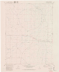
1979 Map of Chilcoot
USGS Topo · Published 1979About this map
Sierra Valley dominates the southern reaches of this landscape, where the Western Pacific Railroad cuts a straight line through the high desert floor. The small settlements of Vinton and Chilcoot serve as the primary hubs of activity, anchored by the Vinton Cem and the Summit Sch. Water management is central to life in this arid basin, evidenced by an extensive network of artificial and natural waterways including the Little Last Chance Channel and North Channel, alongside numerous flowing wells and the Dyson Slough.
Find a feature on this map
31 named features on this map. Tap any name to fly to it.
Don’t see what you’re looking for? This feature index may not catch every label — zoom into the map to look around manually.
Map Details
Editions of this 1979 Chilcoot Map
2 editions found
Other maps of this area

1890 · Sierraville
USGS Topo · 1:125,000

1892 · Sierraville
USGS Topo · 1:125,000

1894 · Sierraville
USGS Topo · 1:125,000

1950 · Chilcoot
USGS Topo · 1:62,500

1950 · Portola
USGS Topo · 1:62,500

1955 · Loyalton
USGS Topo · 1:62,500

1955 · Sierraville
USGS Topo · 1:62,500

1958 · Chico
USGS Topo · 1:250,000

1960 · Chico
USGS Topo · 1:250,000
1972 · Reconnaissance Peak
USGS Topo · 1:24,000