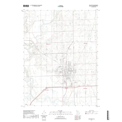
2017 Map of Chillicothe
USGS Topo · Published 2017About this map
Chillicothe serves as the focal point for this survey of Livingston County, situated just north of the confluence where the Thompson River joins the Grand River. The city's grid is well-established, with core streets like Calhoun St, Webster St, and Polk St extending westward toward Coon Cr. The layout illustrates the community's expansion around the historic city center, balanced between the river bottomlands to the south and the rising terrain to the north where Number 56 Lake is located. The map details a transition from the dense urban infrastructure of the county seat to the outlying rural reaches of Utica and the various drainage basins of Blackwell Br and Crooked Cr. Significant local landmarks include Edgewood Cem and an extensive network of county roads that facilitate travel across the river valleys and agricultural sections.
Find a feature on this map
79 named features on this map. Tap any name to fly to it.
Don’t see what you’re looking for? This feature index may not catch every label — zoom into the map to look around manually.
Map Details
Editions of this 2017 Chillicothe Map
This is the sole edition of this map. No revisions or reprints were ever made.
Other maps of this area

1921 · Chillicothe
USGS Topo · 1:62,500

1923 · Chillicothe
USGS Topo · 1:62,500

1924 · Dawn
USGS Topo · 1:62,500

1924 · Chula
USGS Topo · 1:62,500

1924 · Hale
USGS Topo · 1:62,500

1947 · Chula
USGS Topo · 1:62,500

1951 · Utica
USGS Topo · 1:62,500

1951 · Hale
USGS Topo · 1:62,500

1953 · Moberly
USGS Topo · 1:250,000

1954 · Moberly
USGS Topo · 1:250,000