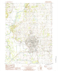
1984 Map of Chillicothe
USGS Topo · Published 1985About this map
The confluence of the Thompson River and the Grand River anchors the southern landscape of this mid-1980s survey, where an extensive system of Levee protections lines the riverbanks and surrounding lowlands. The city of Chillicothe serves as the regional hub, exhibiting a developed grid that includes the Po, City Hall, and a central Hospital. The surrounding terrain is divided into distinct sections such as Jackson, Rich Hill, and Green, indicating local jurisdictional or historical boundaries.
Find a feature on this map
25 named features on this map. Tap any name to fly to it.
Don’t see what you’re looking for? This feature index may not catch every label — zoom into the map to look around manually.
Map Details
Editions of this 1984 Chillicothe Map
This is the sole edition of this map. No revisions or reprints were ever made.
Other maps of this area

1921 · Chillicothe
USGS Topo · 1:62,500

1923 · Chillicothe
USGS Topo · 1:62,500

1924 · Dawn
USGS Topo · 1:62,500

1924 · Chula
USGS Topo · 1:62,500

1924 · Hale
USGS Topo · 1:62,500

1947 · Chula
USGS Topo · 1:62,500

1951 · Utica
USGS Topo · 1:62,500

1951 · Hale
USGS Topo · 1:62,500

1953 · Moberly
USGS Topo · 1:250,000

1954 · Moberly
USGS Topo · 1:250,000