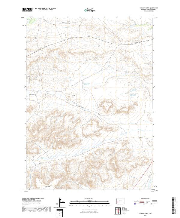
2021 Map of Chimney Butte
USGS Topo · Published 2021About this map
Chimney Butte stands as the central landmark in this portion of the High Plains, overlooking a landscape defined by an intricate network of drainage draws and ranching infrastructure. The topographic detail reveals how water is managed in this arid environment, with features like Yankee Ditch and Green R Island Ditch redirecting flows toward the eastern basins. Small-scale impoundments such as Chimney Butte Reservoir and Flat Top Reservoir provide critical water points across the sagebrush-covered terrain.
Find a feature on this map
25 named features on this map. Tap any name to fly to it.
Don’t see what you’re looking for? This feature index may not catch every label — zoom into the map to look around manually.
Map Details
Editions of this 2021 Chimney Butte Map
This is the sole edition of this map. No revisions or reprints were ever made.
Other maps of this area

1939 · Big Piney
USGS Topo · 1:125,000

1942 · Big Piney
USGS Topo · 1:125,000

1955 · Preston
USGS Topo · 1:250,000

1958 · Preston
USGS Topo · 1:250,000

1962 · Preston
USGS Topo · 1:250,000

1969 · Chimney Butte
USGS Topo · 1:24,000

1969 · La Barge
USGS Topo · 1:24,000
1969 · Milleson Draw
USGS Topo · 1:24,000

1969 · Cretaceous Mountain
USGS Topo · 1:24,000
1969 · The Hogsback
USGS Topo · 1:24,000