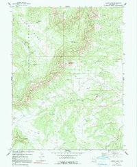
1969 Map of Chimney Rock
USGS Topo · Published 1991About this map
Huff Mountain and the high plateaus of the San Rafael Swell area dominate this 1969 survey, where the rugged topography is punctuated by vital water sources like Wiregrass Spring and Gooseberry Spring. The landscape reflects a history of transit and remote infrastructure, evidenced by a Landing Strip and a Radio Tower positioned on high ground. The presence of several Drill Hole locations suggests a period of exploratory mineral or geological testing within the Chimney Rock Flat and Big Flat areas.
Find a feature on this map
30 named features on this map. Tap any name to fly to it.
Don’t see what you’re looking for? This feature index may not catch every label — zoom into the map to look around manually.
Map Details
Editions of this 1969 Chimney Rock Map
3 editions found
Other maps of this area

1886 · Price River
USGS Topo · 1:250,000

1896 · Price River
USGS Topo · 1:250,000

1948 · Woodside
USGS Topo · 1:62,500

1949 · Woodside
USGS Topo · 1:62,500

1950 · Woodside
USGS Topo · 1:62,500

1953 · Red Plateau SE
USGS Topo · 1:24,000

1953 · Red Plateau SW
USGS Topo · 1:24,000

1953 · Beckwith Peak SW
USGS Topo · 1:24,000

1956 · Price
USGS Topo · 1:250,000

1960 · Price
USGS Topo · 1:250,000