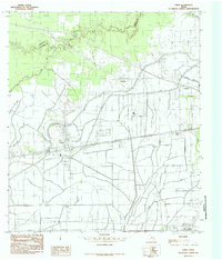
1985 Map of China
USGS Topo · Published 1985About this map
China and its surrounding coastal prairies are defined by an intricate network of water management and drainage in the mid-1980s. The landscape is bisected by the Lower Neches Valley Authority Canal, reflecting the region's historical reliance on engineering to support agriculture and settlement. The northern border follows the winding path of Pine Island Bayou, which separates Jefferson and Hardin counties.
Find a feature on this map
12 named features on this map. Tap any name to fly to it.
Don’t see what you’re looking for? This feature index may not catch every label — zoom into the map to look around manually.
Map Details
Editions of this 1985 China Map
This is the sole edition of this map. No revisions or reprints were ever made.
Other maps of this area

1932 · Beaumont
USGS Topo · 1:62,500

1943 · Fannett East
USGS Topo · 1:24,000

1945 · Fannett East
USGS Topo · 1:31,680

1945 · Nolte
USGS Topo · 1:31,680

1950 · Houston
USGS Topo · 1:250,000

1954 · Beaumont
USGS Topo · 1:250,000

1955 · Sour Lake
USGS Topo · 1:62,500

1956 · Houston
USGS Topo · 1:250,000

1957 · Beaumont
USGS Topo · 1:250,000
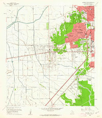
1960 · Beaumont West
USGS Topo · 1:24,000