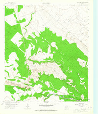
1963 Map of China Lake NE
USGS Topo · Published 1965About this map
The Pecos River winds through the southern edge of this West Texas landscape, serving as the border between Ward and Reeves counties. This arid terrain is defined by a sophisticated water management system designed to support agriculture and industry in the 1960s, featuring the Grand Falls Canal, the Big Valley Canal, and several named wells including Lochabby Well and Smith Well. The land's utility is further underscored by the presence of an aqueduct and a sprawling network of pipelines crossing the Monument Draw.
Find a feature on this map
21 named features on this map. Tap any name to fly to it.
Don’t see what you’re looking for? This feature index may not catch every label — zoom into the map to look around manually.
Map Details
Editions of this 1963 China Lake NE Map
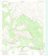
Other maps of this area

1931 · Barstow
USGS Topo · 1:125,000

1954 · Pecos
USGS Topo · 1:250,000

1957 · Pecos
USGS Topo · 1:250,000

1963 · Ligon Ranch
USGS Topo · 1:24,000

1963 · China Lake NE
USGS Topo · 1:24,000

1963 · Rio Pecos Ranch
USGS Topo · 1:24,000

1963 · China Lake
USGS Topo · 1:24,000

1969 · Pyote East
USGS Topo · 1:24,000

1969 · Monahans
USGS Topo · 1:24,000

1969 · 7 L Ranch
USGS Topo · 1:24,000