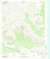
1963 Map of China Lake
USGS Topo · Published 1981About this map
The Pecos River serves as the dividing line between Ward and Reeves counties, defining a landscape of desert water management and energy infrastructure. This mid-century survey, updated in the early 1980s, reveals a complex network of resource extraction and transport, characterized by numerous Oil Wells and Gas Wells scattered across the terrain. The hydrology of the region is notably artificial, with a large Aqueduct, Canal, and multiple Pipelines cutting across the contours to manage water and petroleum products in an arid environment.
Find a feature on this map
12 named features on this map. Tap any name to fly to it.
Don’t see what you’re looking for? This feature index may not catch every label — zoom into the map to look around manually.
Map Details
Editions of this 1963 China Lake Map
2 editions found
Other maps of this area

1931 · Barstow
USGS Topo · 1:125,000

1954 · Pecos
USGS Topo · 1:250,000

1957 · Pecos
USGS Topo · 1:250,000

1963 · Ligon Ranch
USGS Topo · 1:24,000

1963 · Old X Ranch
USGS Topo · 1:24,000

1963 · Quito Draw
USGS Topo · 1:24,000

1963 · China Lake NE
USGS Topo · 1:24,000

1963 · Rio Pecos Ranch
USGS Topo · 1:24,000

1963 · China Lake
USGS Topo · 1:24,000

1968 · Soda Lake SE
USGS Topo · 1:24,000