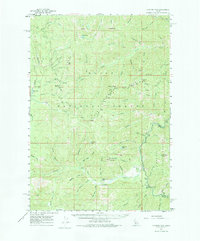
1961 Map of Chinook Mtn
USGS Topo · Published 1975About this map
The Middle Fork Salmon River carves through this portion of the Challis National Forest, creating a landscape defined by dramatic elevation changes and a complex drainage network. Resource extraction is evident through several named claims, including the Portland Mine, Franklin D Mine, and Lucky Lad Mine, which are situated along high ridges and creeks. The presence of the Sulphur Creek Ranch and the Morgan Airstrip indicates a localized infrastructure for aviation and ranching amidst the high peaks. High-altitude observation points like the Morehead Mtn Lookout and Big Soldier Mtn Lookout provide fire surveillance over the surrounding drainages of Sulphur Creek and Pistol Creek. The map also captures the Valley and Custer County border as it traverses various summits, including Chinook Mtn and Walkers Peak.
Find a feature on this map
63 named features on this map. Tap any name to fly to it.
Don’t see what you’re looking for? This feature index may not catch every label — zoom into the map to look around manually.
Map Details
Editions of this 1961 Chinook Mtn Map
2 editions found

Other maps of this area

1891 · Bear Valley
USGS Topo · 1:125,000

1893 · Bear Valley
USGS Topo · 1:125,000

1909 · Garden Valley
USGS Topo · 1:125,000

1937 · Yellow Pine
USGS Topo · 1:48,000

1943 · Yellow Pine
USGS Topo · 1:62,500

1953 · Deadwood Reservoir
USGS Topo · 1:62,500

1954 · Warm Lake
USGS Topo · 1:62,500

1957 · Challis
USGS Topo · 1:250,000

1960 · Challis
USGS Topo · 1:250,000

1961 · Greyhound Ridge
USGS Topo · 1:62,500