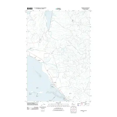
2011 Map of Chinook
USGS Topo · Published 2011About this map
Chinook and its coastal surroundings are defined by the intricate relationship between the Columbia River estuary and the legacy of early Pacific County settlements. The landscape transitions from the tidal flats of Baker Bay to the elevated terrain of Scarboro Hill, where the Fort Columbia Tunnel passes through the ridge. This area maintains a strong connection to its maritime and agricultural roots, evidenced by the concentration of family-named landmarks such as Gile Ranch, Goulter Ranch, and Beeker Ranch. Navigational aids like the Entrance Rear Range Light and the Chinook Dike Light underscore the critical importance of the river channel, while the Chinook Marina serves as a hub for local maritime activity. Further north, the settlement of Stringtown and the waters of Willapa Bay illustrate the thin strip of habitable land tucked between the ridge and the shifting shoreline of the peninsula.
Find a feature on this map
39 named features on this map. Tap any name to fly to it.
Don’t see what you’re looking for? This feature index may not catch every label — zoom into the map to look around manually.
Map Details
Editions of this 2011 Chinook Map
This is the sole edition of this map. No revisions or reprints were ever made.
Other maps of this area

1919 · Astoria
USGS Topo · 1:62,500

1938 · Cape Disappointment
USGS Topo · 1:62,500

1938 · Fort Columbia
USGS Topo · 1:62,500

1939 · Astoria
USGS Topo · 1:62,500

1943 · Fort Columbia
USGS Topo · 1:62,500

1943 · Copalis Beach
USGS Topo · 1:250,000

1949 · Astoria
USGS Topo · 1:24,000

1949 · Chinook
USGS Topo · 1:24,000

1949 · Oman Ranch
USGS Topo · 1:24,000

1949 · Knappton
USGS Topo · 1:24,000