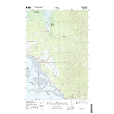
2017 Map of Chinook
USGS Topo · Published 2017About this map
Chinook and the nearby shoreline of Baker Bay define the southern tip of Washington's Long Beach Peninsula at its meeting with the Columbia River. This landscape is marked by significant protected lands, including the Willapa National Wildlife Refuge and Lewis and Clark National Historical Park, where the Fort Columbia Tunnel passes through the high ground of Chinook Point.
Find a feature on this map
34 named features on this map. Tap any name to fly to it.
Don’t see what you’re looking for? This feature index may not catch every label — zoom into the map to look around manually.
Map Details
Editions of this 2017 Chinook Map
This is the sole edition of this map. No revisions or reprints were ever made.
Other maps of this area

1919 · Astoria
USGS Topo · 1:62,500

1938 · Cape Disappointment
USGS Topo · 1:62,500

1938 · Fort Columbia
USGS Topo · 1:62,500

1939 · Astoria
USGS Topo · 1:62,500

1943 · Fort Columbia
USGS Topo · 1:62,500

1943 · Copalis Beach
USGS Topo · 1:250,000

1949 · Astoria
USGS Topo · 1:24,000

1949 · Chinook
USGS Topo · 1:24,000

1949 · Oman Ranch
USGS Topo · 1:24,000

1949 · Knappton
USGS Topo · 1:24,000