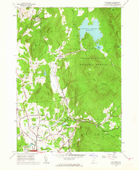
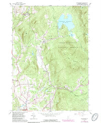
1961 Map of Chittenden
USGS Topo · Published 1964About this map
Chittenden Reservoir dominates the northeastern landscape of this Vermont survey, held by the Chittenden Dam and surrounded by the Green Mountain National Forest. The map documents a period when the timbered slopes of Blue Ridge Mountain and Bald Peak loomed over a valley floor transitioning from early rural industries toward recreation and public works. Along the banks of East Creek, the settlement of Chittenden and its outlying districts like North Chittenden reveal a community deeply rooted in its terrain.
Find a feature on this map
62 named features on this map. Tap any name to fly to it.
Don’t see what you’re looking for? This feature index may not catch every label — zoom into the map to look around manually.
Map Details
Editions of this 1961 Chittenden Map
5 editions found
Other maps of this area

1891 · Rutland
USGS Topo · 1:62,500

1893 · Rutland
USGS Topo · 1:62,500

1895 · Castleton
USGS Topo · 1:62,500

1897 · Castleton
USGS Topo · 1:62,500

1902 · Brandon
USGS Topo · 1:62,500

1904 · Brandon
USGS Topo · 1:62,500

1915 · Rochester
USGS Topo · 1:62,500

1917 · Rochester
USGS Topo · 1:62,500

1920 · Brandon
USGS Topo · 1:62,500

1944 · Proctor
USGS Topo · 1:31,680