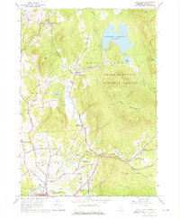
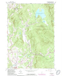
1961 Map of Chittenden
USGS Topo · Published 1976About this map
Chittenden Reservoir dominates the high terrain of this Vermont landscape, held by the Chittenden Dam and surrounded by the Green Mountain National Forest. Below the spillway, East Creek flows southwest through the central valley, connecting the small settlements of Chittenden and East Pittsford. The map reveals a community organized around mountain water and forest resources, featuring the Fish Hatchery near North Chittenden and the Mountain Top Club overlooking the reservoir. Genealogists can locate family landmarks such as Horton Cem and Baird Cem, while historical infrastructure is noted through the District Sch No 15 and the Mill Village Chapel. To the west, the topography rises toward Bald Peak, while the southeastern corner is defined by the Rutland City Forest and the residential streets of the Rutland outskirts.
Find a feature on this map
54 named features on this map. Tap any name to fly to it.
Don’t see what you’re looking for? This feature index may not catch every label — zoom into the map to look around manually.
Map Details
Editions of this 1961 Chittenden Map
5 editions found
Other maps of this area

1891 · Rutland
USGS Topo · 1:62,500

1893 · Rutland
USGS Topo · 1:62,500

1895 · Castleton
USGS Topo · 1:62,500

1897 · Castleton
USGS Topo · 1:62,500

1902 · Brandon
USGS Topo · 1:62,500

1904 · Brandon
USGS Topo · 1:62,500

1915 · Rochester
USGS Topo · 1:62,500

1917 · Rochester
USGS Topo · 1:62,500

1920 · Brandon
USGS Topo · 1:62,500

1944 · Proctor
USGS Topo · 1:31,680