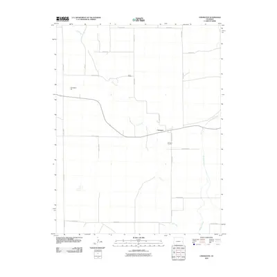
2010 Map of Chivington
USGS Topo · Published 2010About this map
Chivington sits at a geographic crossroads in Kiowa County, where the meandering path of Rush Creek converges with Big Sandy Creek. This high plains landscape is defined by its rectilinear grid of county roads, such as County Road N and County RD 52, which provide the primary framework for the scattered agricultural settlements of the region. The map preserves several points of genealogical interest, including the France Cemetery to the north and the Chivington Cemetery situated just south of the town center. The prominence of Chivington Hill provides a rare point of elevation in a landscape otherwise dominated by wide creek beds and the sprawling infrastructure of rural Colorado. The arrangement of these cemeteries and waterways relative to the established road network offers a clear view of how early 21st-century settlement patterns remained anchored to these vital natural and civic landmarks.
Find a feature on this map
20 named features on this map. Tap any name to fly to it.
Don’t see what you’re looking for? This feature index may not catch every label — zoom into the map to look around manually.
Map Details
Editions of this 2010 Chivington Map
This is the sole edition of this map. No revisions or reprints were ever made.
Other maps of this area

1890 · Granada
USGS Topo · 1:125,000

1891 · Kit Carson
USGS Topo · 1:125,000

1892 · Lamar
USGS Topo · 1:125,000

1892 · Cheyenne Wells
USGS Topo · 1:125,000

1892 · Granada
USGS Topo · 1:125,000

1893 · Kit Carson
USGS Topo · 1:125,000

1894 · Cheyenne Wells
USGS Topo · 1:125,000

1894 · Granada
USGS Topo · 1:125,000

1954 · Lamar
USGS Topo · 1:250,000

1958 · Lamar
USGS Topo · 1:250,000