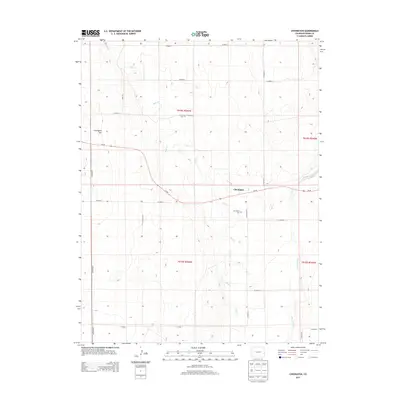
2013 Map of Chivington
USGS Topo · Published 2013About this map
Chivington serves as the central hub of this eastern Colorado landscape, situated along the path of Co-96. The geography is defined by a sparse network of county roads and intermittent waterways, most notably the winding course of Rush Cr and the larger Big Sandy Cr in the southeast. For local history researchers and genealogists, the map identifies specific burial sites including Chivington Cem south of the town and the isolated France Cem further north. Rising above the surrounding plains, Chivington Hill provides a distinct topographic landmark in an area otherwise dominated by the rectilinear grid of township and range boundaries, such as t018s r046w. This survey documents the persistence of small agricultural settlements and the vital road system that connects them across the high plains.
Find a feature on this map
24 named features on this map. Tap any name to fly to it.
Don’t see what you’re looking for? This feature index may not catch every label — zoom into the map to look around manually.
Map Details
Editions of this 2013 Chivington Map
This is the sole edition of this map. No revisions or reprints were ever made.
Other maps of this area
1890 · Granada
USGS Topo · 1:125,000
1891 · Kit Carson
USGS Topo · 1:125,000
1892 · Lamar
USGS Topo · 1:125,000
1892 · Cheyenne Wells
USGS Topo · 1:125,000
1892 · Granada
USGS Topo · 1:125,000
1893 · Kit Carson
USGS Topo · 1:125,000
1894 · Cheyenne Wells
USGS Topo · 1:125,000
1894 · Granada
USGS Topo · 1:125,000
1954 · Lamar
USGS Topo · 1:250,000
1958 · Lamar
USGS Topo · 1:250,000