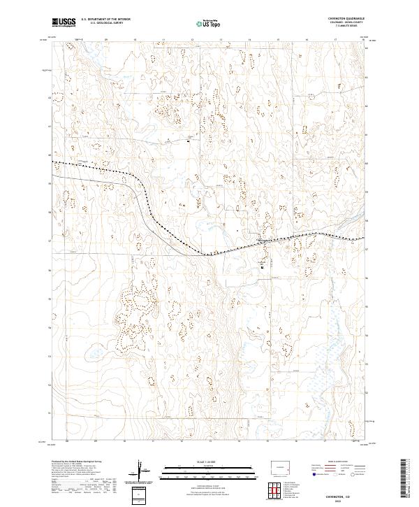
2022 Map of Chivington
USGS Topo · Published 2022About this map
Chivington sits at the heart of this Kiowa County landscape, a community defined by its position along the rail corridor in the high plains of eastern Colorado. The terrain is characterized by the meandering courses of Rush Cr and Big Sandy Cr, which drain the surrounding basin. These waterways provide a stark contrast to the surrounding grid of section lines and ranch roads, illustrating the fundamental relationship between local hydrology and the patterns of settlement in a semi-arid region. The map documents the persistent layout of this small plains settlement as it appeared in the early 21st century, offering a clear view of the road network and topographic relief that has shaped the area since its establishment.
Find a feature on this map
3 named features on this map. Tap any name to fly to it.
Don’t see what you’re looking for? This feature index may not catch every label — zoom into the map to look around manually.
Map Details
Editions of this 2022 Chivington Map
This is the sole edition of this map. No revisions or reprints were ever made.
Other maps of this area

1890 · Granada
USGS Topo · 1:125,000

1891 · Kit Carson
USGS Topo · 1:125,000

1892 · Lamar
USGS Topo · 1:125,000

1892 · Cheyenne Wells
USGS Topo · 1:125,000

1892 · Granada
USGS Topo · 1:125,000

1893 · Kit Carson
USGS Topo · 1:125,000

1894 · Cheyenne Wells
USGS Topo · 1:125,000

1894 · Granada
USGS Topo · 1:125,000

1954 · Lamar
USGS Topo · 1:250,000

1958 · Lamar
USGS Topo · 1:250,000