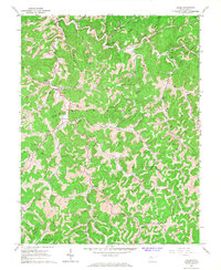
1966 Map of Chloe
USGS Topo · Published 1968About this map
The West Fork Kanawha River and West Fork Little Kanawha River define the intricate drainage patterns of this Central West Virginia landscape. During the mid-1960s, the region was characterized by small, creek-side settlements and a pervasive energy economy, evidenced by the numerous Gas Wells and pipelines scattered throughout the hollows. Local community life centered around places like Minnora, where the Minnora Sch, Minnora Cem, and Prudence Chapel are clustered. The map provides a detailed view of family and local history through its naming of rural landmarks such as Mule Knob and many small family cemeteries. The convergence of three counties — Calhoun, Braxton, and Clay — appears in the southeastern quadrant, illustrating how political boundaries followed the winding ridges and stream beds of the Otter and Birch districts.
Find a feature on this map
52 named features on this map. Tap any name to fly to it.
Don’t see what you’re looking for? This feature index may not catch every label — zoom into the map to look around manually.
Map Details
Editions of this 1966 Chloe Map
2 editions found
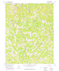
Other maps of this area

1893 · Sutton
USGS Topo · 1:125,000

1906 · Glenville
USGS Topo · 1:62,500

1906 · Otter
USGS Topo · 1:62,500

1907 · Otter
USGS Topo · 1:62,500

1907 · Arnoldsburg
USGS Topo · 1:62,500

1908 · Gassaway
USGS Topo · 1:48,000

1910 · Gassaway
USGS Topo · 1:62,500

1925 · Glenville
USGS Topo · 1:62,500

1925 · Arnoldsburg
USGS Topo · 1:62,500

1927 · Arnoldsburg
USGS Topo · 1:62,500