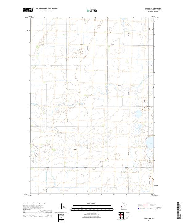
2022 Map of Chokio NW
USGS Topo · Published 2022About this map
The agricultural plains of Stevens County are defined by a rhythmic grid of rural routes and the wandering path of Twelvemile Cr. This 2022 survey illustrates the modern landscape of the Minnesota prairie, where land management is visible through features like County Ditch Number Fifteen. While much of the terrain is dedicated to the section-line road system, including Co Rd 77 and Co Hwy 18, natural depressions in the glacial till persist as water bodies such as Mud Lake and Fish Lake. The confluence of the E Fork Twelvemile Cr with the main creek provides a break in the geometric regularity of the surrounding townships. For those researching family land or local hydrology, the map provides a precise look at the drainage patterns and access roads that have shaped this farming community over generations.
Find a feature on this map
30 named features on this map. Tap any name to fly to it.
Don’t see what you’re looking for? This feature index may not catch every label — zoom into the map to look around manually.
Map Details
Editions of this 2022 Chokio NW Map
This is the sole edition of this map. No revisions or reprints were ever made.
Other maps of this area

1910 · Chokio
USGS Topo · 1:62,500

1911 · Herman
USGS Topo · 1:62,500

1912 · Chokio
USGS Topo · 1:62,500

1950 · Graceville
USGS Topo · 1:62,500

1951 · Wheaton
USGS Topo · 1:62,500

1953 · Milbank
USGS Topo · 1:250,000

1958 · Milbank
USGS Topo · 1:250,000
1973 · Alberta
USGS Topo · 1:24,000
1973 · Herman
USGS Topo · 1:24,000
1973 · Donnelly
USGS Topo · 1:24,000