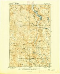
1906 Map of Chopaka
USGS Topo · Published 1948About this map
The United States Canada Boundary Line defines the northern edge of this rugged Okanogan landscape, where the Similkameen River flows through the northern valleys past the settlement of Nighthawk. This era of the early twentieth century shows a region defined by high-altitude mining and early pioneer towns. Several significant mining operations are visible near Palmer Lake, including the Grandview Mine and Bear Mine, while the small settlement of Golden sits tucked near Wannacut Lake.
Find a feature on this map
80 named features on this map. Tap any name to fly to it.
Don’t see what you’re looking for? This feature index may not catch every label — zoom into the map to look around manually.
Map Details
Editions of this 1906 Chopaka Map
3 editions found
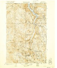
Other maps of this area

1899 · Methow
USGS Topo · 1:125,000

1901 · Methow
USGS Topo · 1:125,000

1902 · Osoyoos
USGS Topo · 1:125,000

1904 · Osoyoos
USGS Topo · 1:125,000

1905 · Okanogan
USGS Topo · 1:125,000

1906 · Chopaka
USGS Topo · 1:125,000

1953 · Omak Lake
USGS Topo · 1:62,500

1954 · Okanogan
USGS Topo · 1:250,000

1955 · Concrete
USGS Topo · 1:250,000

1956 · Loup Loup
USGS Topo · 1:62,500