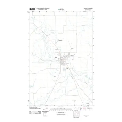
2011 Map of Choteau
USGS Topo · Published 2011About this map
Choteau serves as the focal point of this western Montana landscape, situated at the confluence of several vital water sources including the Teton River, Spring Creek, and Deep Creek. The town's layout is meticulously detailed, showing the locations of the Choteau Post Office, Choteau Vol Fire Dept, and the local Choteau Cemetery. The surrounding plains are marked by significant landmarks such as Truchot Hill to the north and the prominent Rattlesnake Butte and Priest Butte to the south. This area demonstrates a complex hydraulic network of irrigation and water management, evidenced by the Cascade Canal, the S T Canal, and the Choteau Sewage Lagoon Dam. Transportation and recreation are well-represented by the Choteau Airport and the Choteau KOA Campground, reflecting a community that balances its agricultural roots with modern infrastructure and travel connections.
Find a feature on this map
50 named features on this map. Tap any name to fly to it.
Don’t see what you’re looking for? This feature index may not catch every label — zoom into the map to look around manually.
Map Details
Editions of this 2011 Choteau Map
This is the sole edition of this map. No revisions or reprints were ever made.
Other maps of this area

1920 · Choteau
USGS Topo · 1:125,000

1955 · Choteau
USGS Topo · 1:250,000

1957 · Choteau
USGS Topo · 1:250,000

1958 · Choteau
USGS Topo · 1:250,000

1960 · Bynum
USGS Topo · 1:62,500

1960 · Choteau
USGS Topo · 1:62,500

1960 · Gilman
USGS Topo · 1:62,500
1960 · Freezeout Lake
USGS Topo · 1:62,500

1962 · Choteau
USGS Topo · 1:250,000
1976 · Choteau
USGS Topo · 1:250,000