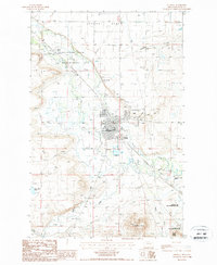
1987 Map of Choteau
USGS Topo · Published 1987About this map
Choteau serves as the focal point for this 1980s landscape, where the Teton River and its accompanying irrigation infrastructure define the local geography. The map documents a town layout featuring a Trailer Park, a local Airport with a Beacon, and a Golf Course, illustrating the community's mid-century expansion. North of the town center, Choteau Junction marks a key intersection near Truchot Hill, while the expansive Burton Bench plateau dominates the northern horizon.
Find a feature on this map
36 named features on this map. Tap any name to fly to it.
Don’t see what you’re looking for? This feature index may not catch every label — zoom into the map to look around manually.
Map Details
Editions of this 1987 Choteau Map
This is the sole edition of this map. No revisions or reprints were ever made.
Other maps of this area

1920 · Choteau
USGS Topo · 1:125,000

1955 · Choteau
USGS Topo · 1:250,000

1957 · Choteau
USGS Topo · 1:250,000

1958 · Choteau
USGS Topo · 1:250,000

1960 · Bynum
USGS Topo · 1:62,500

1960 · Choteau
USGS Topo · 1:62,500

1960 · Gilman
USGS Topo · 1:62,500
1960 · Freezeout Lake
USGS Topo · 1:62,500

1962 · Choteau
USGS Topo · 1:250,000
1976 · Choteau
USGS Topo · 1:250,000