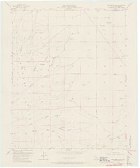
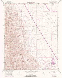
1956 Map of Chounet Ranch
USGS Topo · Published 1966About this map
The Panoche Hills dominate this mid-century landscape in Fresno County, revealing a terrain deeply etched by seasonal drainage systems. The rugged western slopes are characterized by numerous named canyons including Marca Canyon, Capita Canyon, and the distinctively named Right Angle Canyon. These watercourses flow eastward from the hills toward the flatter agricultural lands of the Central Valley.
Find a feature on this map
30 named features on this map. Tap any name to fly to it.
Don’t see what you’re looking for? This feature index may not catch every label — zoom into the map to look around manually.
Map Details
Editions of this 1956 Chounet Ranch Map
5 editions found
Other maps of this area

1913 · Panoche
USGS Topo · 1:125,000

1921 · Laguna Seca Ranch
USGS Topo · 1:31,680

1921 · Tierra Loma School
USGS Topo · 1:31,680

1922 · Chaney Ranch
USGS Topo · 1:31,680

1923 · Laguna Seca Ranch
USGS Topo · 1:31,680

1923 · Wisdom Well
USGS Topo · 1:31,680

1923 · Tierra Loma School
USGS Topo · 1:31,680

1923 · Little Panoche
USGS Topo · 1:31,680

1923 · Monocline Ridge
USGS Topo · 1:31,680

1943 · Ortigalita Peak
USGS Topo · 1:62,500