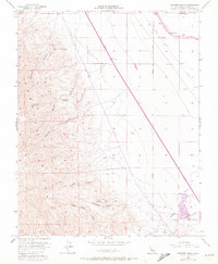
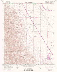
1956 Map of Chounet Ranch
USGS Topo · Published 1972About this map
Chounet Ranch and Wood Ranch anchor the eastern flatlands of Fresno County, where the infrastructure of the California Aqueduct and multiple pipelines cut across the arid landscape. The topography transitions sharply from the alluvial plains into the dissected ridges of the Panoche Hills, marked by deep erosional features like Moreno Gulch and Gres Canyon. Traces of early industrial activity appear as a Prospect near Nonada Hill and a Gravel Pit along the southern wash. The map captures a period of significant water engineering, with the aqueduct and Russell Avenue defining the north-south transport corridors. This 1956 survey, updated with 1971 aerial data, documents the complex drainage systems of Marca Capita Canyon and Dosados Canyon as they descend toward the ephemeral Panoche Creek.
Find a feature on this map
22 named features on this map. Tap any name to fly to it.
Don’t see what you’re looking for? This feature index may not catch every label — zoom into the map to look around manually.
Map Details
Editions of this 1956 Chounet Ranch Map
5 editions found
Other maps of this area

1913 · Panoche
USGS Topo · 1:125,000

1921 · Laguna Seca Ranch
USGS Topo · 1:31,680

1921 · Tierra Loma School
USGS Topo · 1:31,680

1922 · Chaney Ranch
USGS Topo · 1:31,680

1923 · Laguna Seca Ranch
USGS Topo · 1:31,680

1923 · Wisdom Well
USGS Topo · 1:31,680

1923 · Tierra Loma School
USGS Topo · 1:31,680

1923 · Little Panoche
USGS Topo · 1:31,680

1923 · Monocline Ridge
USGS Topo · 1:31,680

1943 · Ortigalita Peak
USGS Topo · 1:62,500