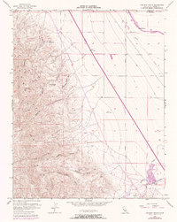
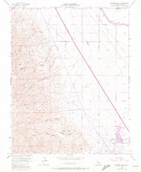
1956 Map of Chounet Ranch
USGS Topo · Published 1972About this map
Panoche Hills dominate the western half of this Fresno County landscape, where deep-cut drainages like Moreno Gulch and Marca Capita Canyon descend from high peaks. The 1956 survey, updated with 1971 aerial observations, reveals a stark transition from these steep elevations toward the agricultural lowlands to the east. Infrastructure developments like the California Aqueduct and multiple pipelines cut across the alluvial fans, following the contours of the valley floor. Settlement is sparse, represented by established sites such as Chounet Ranch and Wood Ranch near the northern boundary. Along the southern edge, Panoche Creek winds toward a Gravel Pit, while the intersection of Panoche Road and Russell Avenue provides a primary point of access to this interior ranching and resource corridor. Geodetic markers like VABM Indian (1955) 2384 signify the importance of this terrain for regional surveying and water management planning.
Find a feature on this map
35 named features on this map. Tap any name to fly to it.
Don’t see what you’re looking for? This feature index may not catch every label — zoom into the map to look around manually.
Map Details
Editions of this 1956 Chounet Ranch Map
5 editions found
Other maps of this area

1913 · Panoche
USGS Topo · 1:125,000

1921 · Laguna Seca Ranch
USGS Topo · 1:31,680

1921 · Tierra Loma School
USGS Topo · 1:31,680

1922 · Chaney Ranch
USGS Topo · 1:31,680

1923 · Laguna Seca Ranch
USGS Topo · 1:31,680

1923 · Wisdom Well
USGS Topo · 1:31,680

1923 · Tierra Loma School
USGS Topo · 1:31,680

1923 · Little Panoche
USGS Topo · 1:31,680

1923 · Monocline Ridge
USGS Topo · 1:31,680

1943 · Ortigalita Peak
USGS Topo · 1:62,500