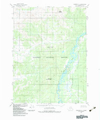
1983 Map of Christian C-1
USGS Topo · Published 1983About this map
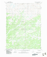
Arctic National Wildlife Refuge encompasses this entire northern landscape, documented by the Geological Survey during a period of refined environmental mapping in the early 1980s. The terrain is defined by the high elevations of the Brooks Range, including Helmet Mountain in the north and White Snow Mountain near the center. The Sheenjek River meanders through the eastern portion of the quadrangle, creating a complex network of braided channels and ponds. This map provides a technical view of the region's hydrology and topography as it existed after the establishment of the expanded refuge boundaries in 1980, showing a wilderness area devoid of roads or permanent human settlements.
Find a feature on this map
4 named features on this map. Tap any name to fly to it.
Don’t see what you’re looking for? This feature index may not catch every label — zoom into the map to look around manually.
Map Details
Editions of this 1983 Christian C-1 Map
This is the sole edition of this map. No revisions or reprints were ever made.
Other maps of this area

1951 · Coleen
USGS Topo · 1:250,000

1951 · Christian
USGS Topo · 1:250,000

1956 · Coleen
USGS Topo · 1:250,000

1956 · Christian
USGS Topo · 1:250,000

1972 · Coleen D-6
USGS Topo · 1:63,360
1972 · Christian D-2
USGS Topo · 1:63,360
1973 · Christian D-1
USGS Topo · 1:63,360
1983 · Coleen C-6
USGS Topo · 1:63,360
1983 · Christian C-2
USGS Topo · 1:63,360
1990 · Christian B-2
USGS Topo · 1:63,360