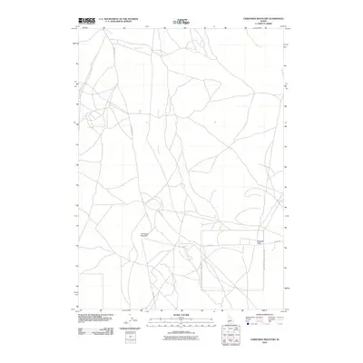
2010 Map of Christmas Mountain
USGS Topo · Published 2010About this map
Christmas Mountain and Flagstaff Butte rise as prominent landmarks in this high-desert region of Ada County. This area in the early 21st century is defined by its sparse road network and the significant presence of the Ada County National Guard Area, which occupies a large portion of the southern landscape. The terrain is marked by seasonal drainages like Sand Creek and a web of unpaved tracks and throughways, including S McConnell Rd and Range Rd. The map illustrates a place primarily dedicated to military training and open-range land use, with very few permanent structures or residential settlements visible, preserving a snapshot of the high-desert interior before further regional expansion.
Find a feature on this map
6 named features on this map. Tap any name to fly to it.
Don’t see what you’re looking for? This feature index may not catch every label — zoom into the map to look around manually.
Map Details
Editions of this 2010 Christmas Mountain Map
This is the sole edition of this map. No revisions or reprints were ever made.
Other maps of this area

1892 · Bisuka
USGS Topo · 1:125,000

1894 · Bisuka
USGS Topo · 1:125,000

1947 · Wild Horse Butte
USGS Topo · 1:24,000

1948 · Big Foot Butte
USGS Topo · 1:24,000

1948 · Wild Horse Butte
USGS Topo · 1:24,000

1948 · Big Foot Butte
USGS Topo · 1:62,500

1948 · Little Joe Butte
USGS Topo · 1:24,000

1949 · Little Joe Butte
USGS Topo · 1:24,000

1949 · Oreana
USGS Topo · 1:62,500

1955 · Christmas Mtn
USGS Topo · 1:24,000