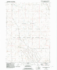
1992 Map of Christmas Mountain
USGS Topo · Published 1992About this map
The Idaho National Guard Training and Maneuver Area dominates this high-desert landscape in Ada County, reflecting the region's mid-century military utility. Mapping revealed here shows a specialized environment where topographic features like Christmas Mountain and Flagstaff Butte served as prominent landmarks for navigation and training exercises. A Lookout Tower and a Storage Bunker are situated near the mountain peak, suggesting an infrastructure built for observation and tactical support.
Find a feature on this map
15 named features on this map. Tap any name to fly to it.
Don’t see what you’re looking for? This feature index may not catch every label — zoom into the map to look around manually.
Map Details
Editions of this 1992 Christmas Mountain Map
This is the sole edition of this map. No revisions or reprints were ever made.
Other maps of this area

1892 · Bisuka
USGS Topo · 1:125,000

1894 · Bisuka
USGS Topo · 1:125,000

1947 · Wild Horse Butte
USGS Topo · 1:24,000

1948 · Big Foot Butte
USGS Topo · 1:24,000

1948 · Wild Horse Butte
USGS Topo · 1:24,000

1948 · Big Foot Butte
USGS Topo · 1:62,500

1948 · Little Joe Butte
USGS Topo · 1:24,000

1949 · Little Joe Butte
USGS Topo · 1:24,000

1949 · Oreana
USGS Topo · 1:62,500

1955 · Christmas Mtn
USGS Topo · 1:24,000