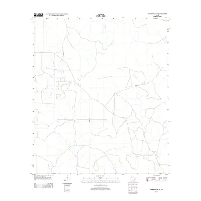
2012 Map of Christoval SE
USGS Topo · Published 2012About this map
The Toenail Oil Field anchors this portion of Tom Green County, reflecting the region's long-standing connection to petroleum extraction. This landscape is defined by a sparse network of county roads and distinctive ranch paths like Toenail Trl and Door Key Rd, which traverse the open country between seasonal watercourses. Natural drainage for the area is provided by Kickapoo Cr, Pecan Cr, and Dry Cr, which carve subtle patterns across the terrain. The presence of named tracks such as Toe Nail Trl and Harris Ln suggests a history of private landholdings and specific ranch access points common in West Texas. This 2012 survey captures the area as it appeared just after the turn of the twenty-first century, showing the intersection of traditional land use and industrial infrastructure via Rudd Rd and various service routes.
Find a feature on this map
11 named features on this map. Tap any name to fly to it.
Don’t see what you’re looking for? This feature index may not catch every label — zoom into the map to look around manually.
Map Details
Editions of this 2012 Christoval SE Map
This is the sole edition of this map. No revisions or reprints were ever made.
Other maps of this area

1892 · San Angelo
USGS Topo · 1:125,000

1893 · Fort McKavett
USGS Topo · 1:125,000

1954 · Sonora
USGS Topo · 1:250,000

1954 · San Angelo
USGS Topo · 1:250,000

1958 · Sonora
USGS Topo · 1:250,000

1958 · San Angelo
USGS Topo · 1:250,000

1963 · Adams
USGS Topo · 1:24,000

1963 · Adams NW
USGS Topo · 1:24,000

1965 · San Angelo
USGS Topo · 1:250,000

1970 · Rocking Chair Ranch
USGS Topo · 1:24,000