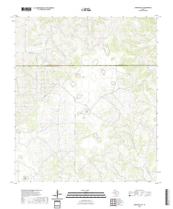
2022 Map of Christoval SE
USGS Topo · Published 2022About this map
The county line between Tom Green Co and Schleicher Co bisects this West Texas ranchland, where the topography is defined by the headwaters of several drainages. Seasonal watercourses such as Pecan Cr and Kickapoo Cr carve through the plateau, creating a network of draws and breaks typical of the Edwards Plateau region. The landscape is marked by landforms like East Poor Hollow and Dry Cr, which illustrate the drainage patterns that have shaped local ranching boundaries for generations. Transportation in this area is primarily comprised of rural routes and ranch access ways, including Ranch Rd 2084 and the descriptively named Door Key Rd. Smaller connectors like Harris Ln, Co Rd 345, and Rudd Rd provide insight into the rural property divisions and historical family-named landmarks that anchor this part of the Concho Valley hinterland.
Find a feature on this map
12 named features on this map. Tap any name to fly to it.
Don’t see what you’re looking for? This feature index may not catch every label — zoom into the map to look around manually.
Map Details
Editions of this 2022 Christoval SE Map
This is the sole edition of this map. No revisions or reprints were ever made.
Other maps of this area

1892 · San Angelo
USGS Topo · 1:125,000

1893 · Fort McKavett
USGS Topo · 1:125,000

1954 · Sonora
USGS Topo · 1:250,000

1954 · San Angelo
USGS Topo · 1:250,000

1958 · Sonora
USGS Topo · 1:250,000

1958 · San Angelo
USGS Topo · 1:250,000

1963 · Adams
USGS Topo · 1:24,000

1963 · Adams NW
USGS Topo · 1:24,000

1965 · San Angelo
USGS Topo · 1:250,000

1970 · Rocking Chair Ranch
USGS Topo · 1:24,000