
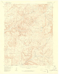
1957 Map of Chromo
USGS Topo · Published 1959About this map
Chromo and the high-country borderlands of southern Colorado take center stage in this mid-century topographic record. Located within the San Juan National Forest, the landscape is defined by the convergence of the Navajo River and the Little Navajo River near the small settlement of Edith. The terrain rises sharply toward the Chalk Mountains and Archuleta Mesa, with cattle and sheep ranching evidenced by numerous pack trails and isolated landmarks like Squaretop Guard Station and the Artesian Well on the Navajo River.
Find a feature on this map
78 named features on this map. Tap any name to fly to it.
Don’t see what you’re looking for? This feature index may not catch every label — zoom into the map to look around manually.
Map Details
Editions of this 1957 Chromo Map
5 editions found
Other maps of this area

1889 · Largo
USGS Topo · 1:250,000

1895 · Largo
USGS Topo · 1:250,000

1913 · Summitville
USGS Topo · 1:125,000

1915 · Summitville
USGS Topo · 1:125,000

1924 · Pagosa Springs
USGS Topo · 1:125,000

1927 · Pagosa Springs
USGS Topo · 1:125,000

1945 · Durango
USGS Topo · 1:250,000

1953 · Durango
USGS Topo · 1:250,000

1954 · Durango
USGS Topo · 1:250,000

1954 · Aztec
USGS Topo · 1:250,000